Da Hengduan, a concentration of world-class landscapes
Sichuan-Aba Prefecture-Jiujiahai(Elevation 4900 meters, photographed in 2013)
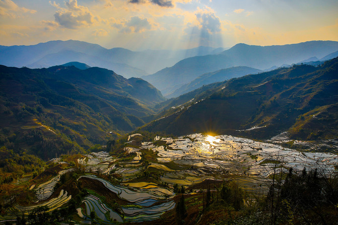
Yunnan-Honghe Prefecture-Yuanyang terrace(World Heritage, 5A-level scenic spot, photographed in 2015)
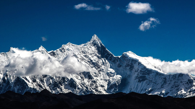
Xizang-Nyingchi City-Nanga bawa peak(7782 meters above sea level, photographed in 2013)

Speaking of the Hengduan Mountains, you may not know it, but when it comes to Jiuzhaigou, it is famous all over the world.
The Hengduan Mountains, with an area of about 360,000 square kilometers and 1961 glaciers, runs north-south, with an average altitude of 4-5 kilometers;
The natural scenery here can be comparable to the scenery of any place in the world;
In Asia, there is no region where world-class attractions are gathered together like here;
It covers northwest Sichuan, eastern Xizang, and northwest Yunnan, and is intertwined with the Qinghai-Tibet Plateau and the Qinling Mountains;
It includes Jiuzhaigou, Huanglong, King of Shushan, Siguniang Mountain, Giant Panda Base, Daocheng Yading, Lugu Lake, Lijiang Dali, Meili Snow Mountain and other most famous places.
[My Story]
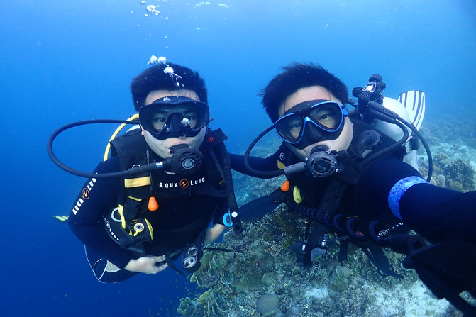
[I am] Kiki, obsessed with world heritage and natural geographical landscapes
[Cooperation] Ctrip signed travelers, Vision China signed photographers, Hailuo Creative signed contributors, vivo mobile phone signed photographers, Tuchong signed contributors, * Photo Commercial Library photographers;
In March 2014, he started his gap year global travel, leaving the country by land from Guangxi and traveling through Southeast Asia, South Asia, the Middle East, North Africa, Western Europe, and Eastern Europe. In July 2016, he took the world's longest Siberian Railway and crossed 9288 kilometers back to Harbin, China. End the journey.
Jumping umbrellas high in the Mediterranean, diving in Southeast Asia, experiencing the crazy Red Festival in India, crossing the Taliban mountains under the escort of Iranian and Pakistan military police, camping in the Moon Canyon with the Bedouin, and Berbers drove across the Eastern and Western Sahara deserts by themselves, crowded with African ironmen on boats to cross the Red Sea, and turned around Gang Rinpoqi in the Tibetan Year of the Horse...
I would like to share with you what I saw and heard along the way, and feel the beauty of the motherland and the excitement of the world together.

Starting from Chengdu or Kunming, you can enter the Hengduan Mountains within a short drive;
Over the years, whether it is hiking or driving, the Hengduan Mountains have been like a cornucopia. When opened everywhere, they have become the ultimate natural landscape;
It shows the beauty of nature here, and I feel happy to be in it;
There are no strategies in this issue, we only talk about the beauty of Hengduan.
[Sichuan District]

Aba Prefecture-Jiuzhaigou-Colorful Pool(Photo taken in the winter of 2012)

Jiuzhaigou-Rhinoceros Sea(Photo taken in autumn 2014)

Jiuzhaigou-Wuhua Sea(Photo taken in autumn 2014)

Jiuzhaigou-Reed Sea(Photo taken in the winter of 2012)

Jiuzhaigou-Nuorilang Waterfall(Elevation 2365 meters, photographed in the winter of 2012)
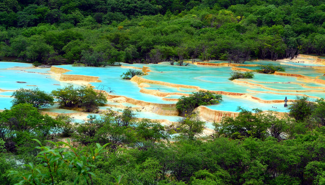

Songpan County-Huanglong-Calcium Pond(Photo taken in the summer of 2014)

Huanglong-Colorful Pool(3500 meters above sea level, photographed in autumn 2015)
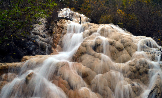
Huanglong-Zhaga Waterfall(3270 meters above sea level, photographed in autumn 2015)
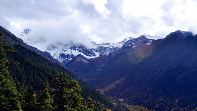
Huanglong-Xuebao Ding(5588 meters above sea level, photographed in autumn 2015),The highest peak in the Minshan Mountains
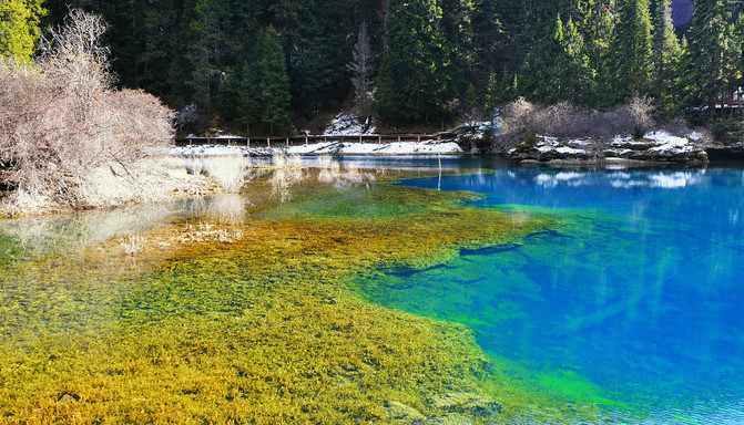
Songpan County-Munigou-Erdaohai(3385 meters above sea level, photographed in autumn 2014)
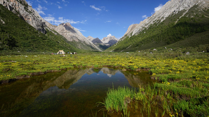
Songpan County-Qizanggou-Chanhaizi(3800 meters above sea level, photographed in summer 2016)
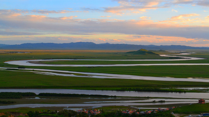
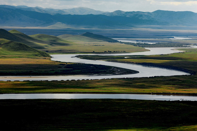
Tangke Township-The First Bay of Jiuqu of the Yellow River(3500 meters above sea level, photographed in the summer of 2013)

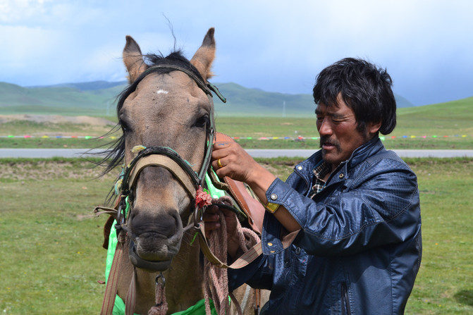
Aba Prefecture-Zoige Grassland(3500 meters above sea level, photographed in the summer of 2013)
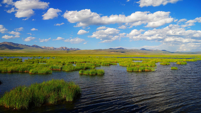
Zoige Grassland-Huahu(Photo taken in the summer of 2013)
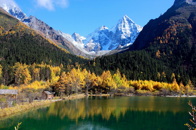
Li County-Bipenggou-Panyang Lake(3600 meters above sea level, photographed in autumn 2014)
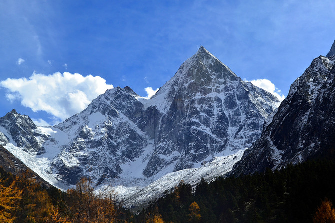
Bipenggou-Crescent Snow Mountain(5430 meters above sea level, photographed in autumn 2014)
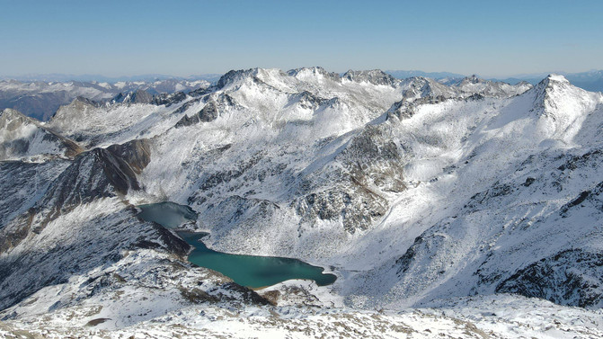
Heishui County-dagu Glacier(4860 meters above sea level, photographed in autumn 2014)

Wolong Reserve-balang mountain(Highway Pass is 4481 meters above sea level, photographed in autumn 2014)
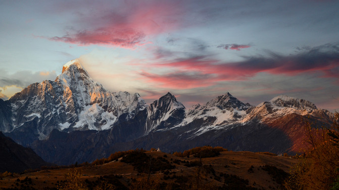
Xiaojin County-Siguniang Mountain-Cat Bridge Observation Platform(3400 meters above sea level, photographed in autumn 2014)
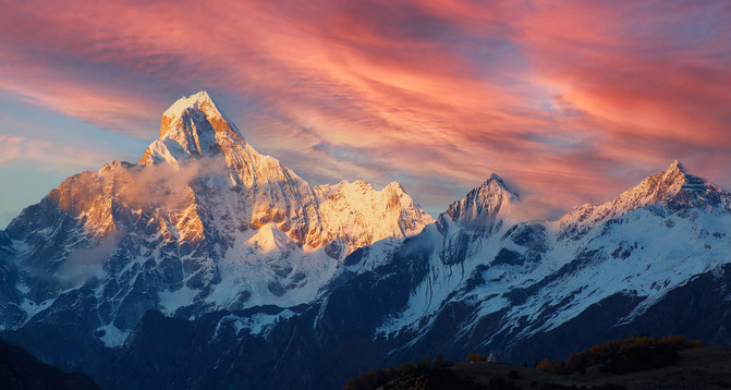
siguniang mountain(The main peak, Yaomei Peak, is 6250 meters above sea level),Highest peak in Qionglai Mountains
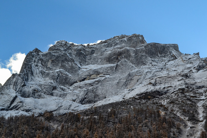
Shuangqiaogou in Siguniang Mountain-Potala Peak(5240 meters above sea level, photographed in autumn 2014)
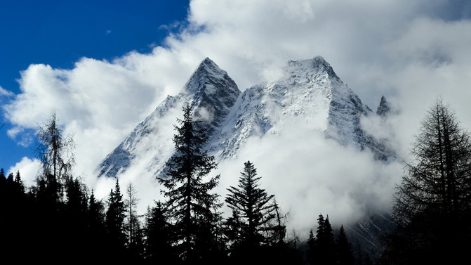
Shuangqiaogou in Siguniang Mountain-Hunter Peak(5360 meters above sea level, photographed in autumn 2014)
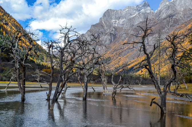
Shuangqiaogou in Siguniang Mountain-Bonsai Beach(3490 meters above sea level, photographed in autumn 2014)

Rilong County-stupa(3140 meters above sea level, photographed in the summer of 2020)
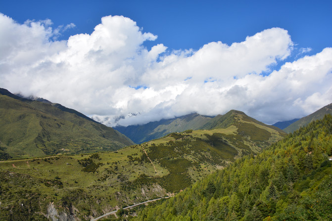
Xiaojin County-Jiajinshan National Forest Park(4114 meters above sea level, photographed in the summer of 2020)
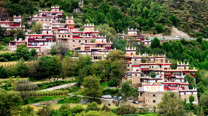
Danba County-Jiajuzangzhai(2100 meters above sea level, photographed in the autumn of 2020)
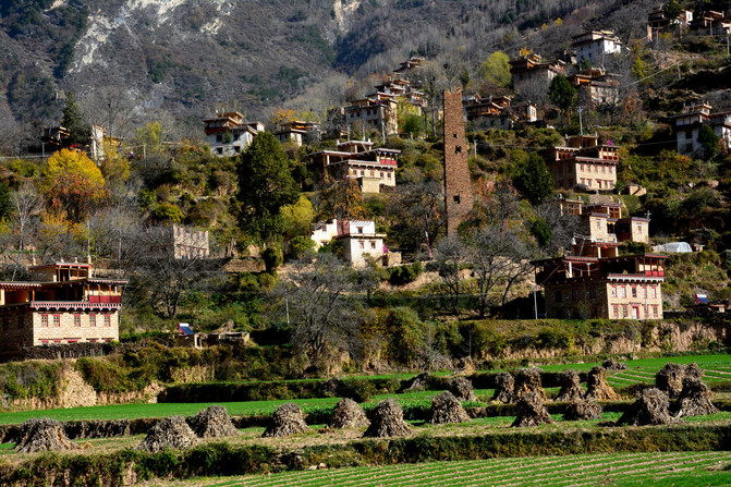
Danba County-Zhongluzangzhai(2100 meters above sea level, photographed in the autumn of 2020)
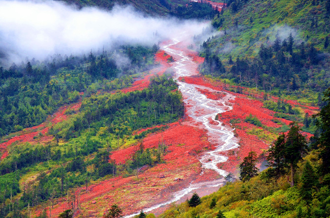
Kangding City-Yajiageng Hongshitan(3800 meters above sea level, photographed in the autumn of 2020)

Luding County-Hailuogou No. 4 Glacier Observation Platform(3600 meters above sea level, photographed in winter 2015)

Luding County-iron chain Bridge(Photo taken in the autumn of 2020)

Ganzi Prefecture-Daocheng Yanding-Chong Ancient Meadow(3850 meters above sea level, photographed in the autumn of 2014)
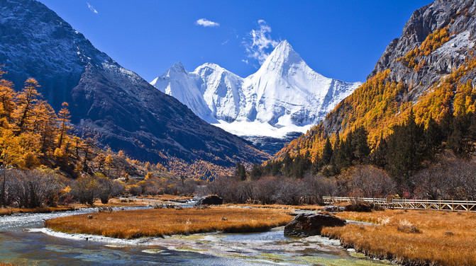
Daocheng Yading-Luorong Cattle Farm(4150 meters above sea level, photographed in the autumn of 2014)
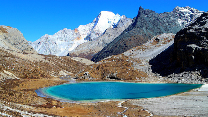
Daocheng Yading-Milk Sea(4600 meters above sea level, photographed in autumn 2014)
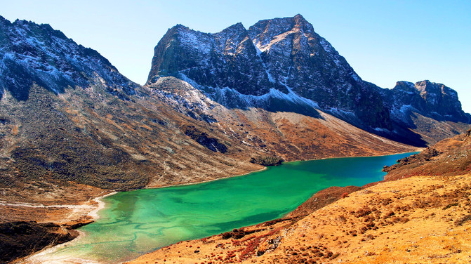
Daocheng Yading-Five Color Sea(4700 meters above sea level, photographed in the autumn of 2014)
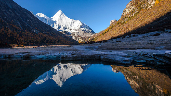
Daocheng Yading-Yangmaiyong Shenshan(5958 meters above sea level, photographed in the autumn of 2014)

Daocheng Yading-Xiannairi Mountain(6032 meters above sea level, photographed in the autumn of 2014)

Ganzi Prefecture-Daofu County-Jinding on Yala Snow Mountain(5884 meters above sea level, photographed in the autumn of 2014)

Ganzi Prefecture-Seda County-Larong Wuming Buddhist College(3900 meters above sea level, photographed in the autumn of 2014)

Ganzi Prefecture-Dege County-Xinluhai(4040 meters above sea level, photographed in the autumn of 2014)
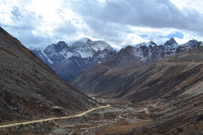
G317/Ganzi Section of the North Sichuan-Tibet Line(4890 meters above sea level, photographed in the autumn of 2014)

G317/Northern Sichuan-Tibet Line-Queershan(6168 meters above sea level, photographed in the autumn of 2014)
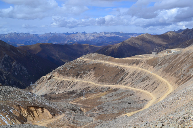
G317/Northern Sichuan-Tibet Line-Laohuzuiyakou(5050 meters above sea level, photographed in the autumn of 2014, the highest altitude pass on the Sichuan-Tibet line)
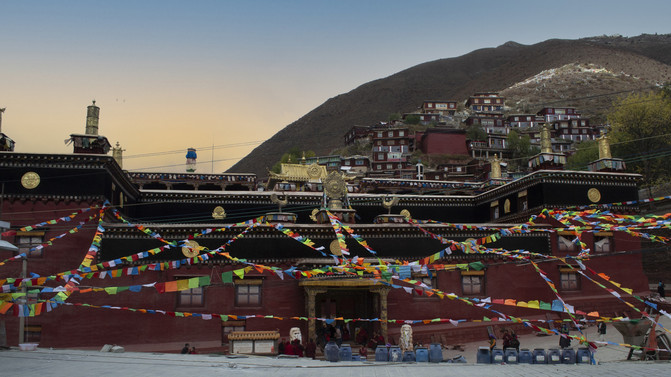
Ganzi Prefecture-Dege Book Printing Institute(3260 meters above sea level, photographed in the autumn of 2014, Encyclopedia of Tibetan Culture)

Ganzi Prefecture-Baiyu County-Tibetan-style dwellings(3300 meters above sea level, photographed in the autumn of 2014)
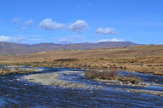
Ganzi Prefecture-Baiyu County-Changtai Grassland(4000 meters above sea level, photographed in the autumn of 2014)
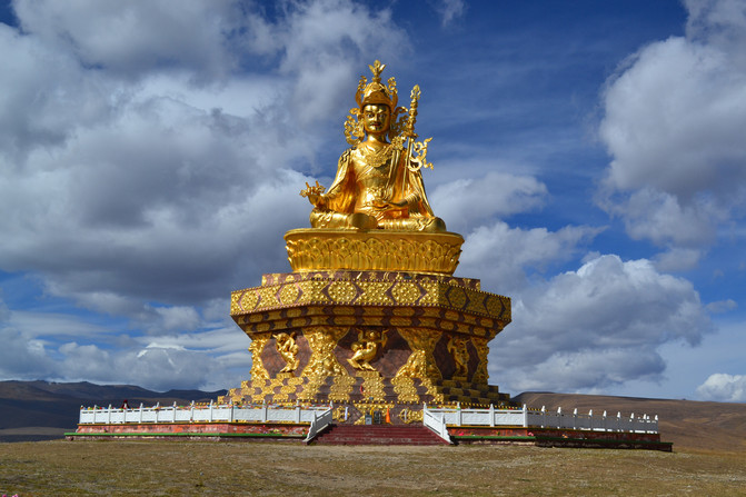

Ganzi Prefecture-Baiyu County-Yaqing Temple-Statue of Master Lianhuanhua(4100 meters above sea level, photographed in the autumn of 2014)

yaqing temple(4000 meters above sea level, photographed in the autumn of 2014, the world's largest Juemu practice site)

Ganzi Prefecture-Xinlong County-Yalong River(2760 meters above sea level, photographed in the autumn of 2014)

Ganzi Prefecture-Xinlong County-Yalong River Grand Canyon(The canyon is 175 kilometers long, photographed in the autumn of 2014)
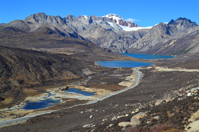
G318/Sichuan-Tibet Southern Line-Litang County-Sister Lake of Haizi Mountain(4685 meters above sea level, photographed in the autumn of 2014)
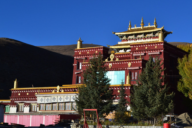
Ganzi Prefecture-Litang County-Changqingchun Keer Temple(4104 meters above sea level, photographed in the autumn of 2014)
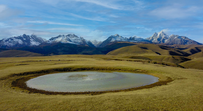
Ganzi Prefecture-Litang County-Eye of Ge Nie(6204 meters above sea level, photographed in the autumn of 2014),The highest peak of the Shaluri Mountains

Ganzi Prefecture-Batang County-Cuopugou Zha Jinjiabo Mountain(4300 meters above sea level, photographed in the autumn of 2014)
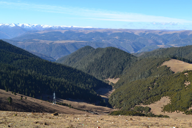
G318/Sichuan-Tibet Southern Line-Jianziwan Mountain(4659 meters above sea level, photographed in the autumn of 2014)

G318/Blackstone City Observation Deck-Gongga Shenshan(7556 meters above sea level, photographed in the autumn of 2014),The highest peak of the Dashueshan Mountains
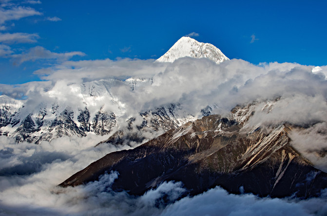
Ganzi Prefecture-Gongga Township-Zimeiyakou Observation Deck-Gongga Shenshan(4500 meters above sea level, photographed in the summer of 2016)
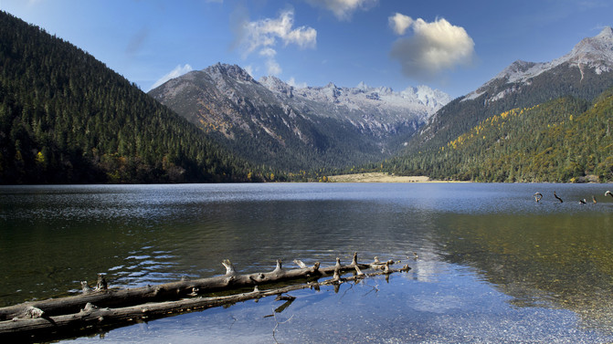
Ganzi Prefecture-Jiulong County-Wu Xuhai(3500 meters above sea level, photographed in the summer of 2016)
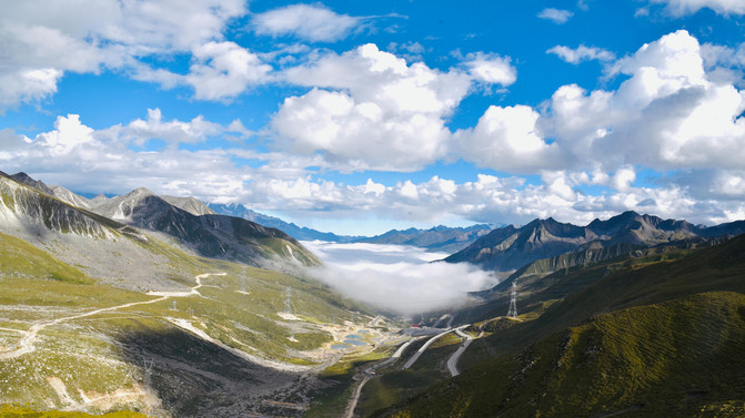
G318/Sichuan-Tibet Southern Line-zheduo mountain(4298 meters above sea level, photographed in the summer of 2012)
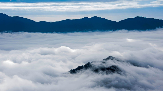
G318/Sichuan-Tibet Southern Line-Ya 'an city-Erlang Mountain(3437 meters above sea level, photographed in the summer of 2012)


Ya 'an city-Bifengxia Panda Base(Photo taken in the summer of 2019)
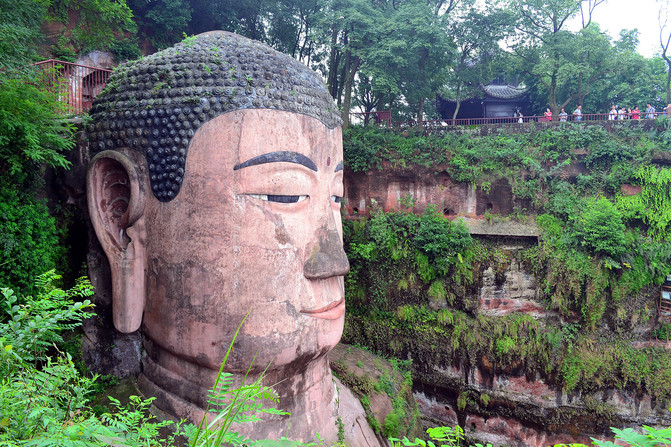
Leshan City-Leshan Giant Buddha(Photo taken in the summer of 2016)
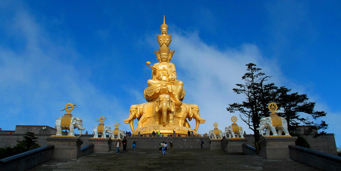
Leshan City-Emei Mountain(Jinding is 3009 meters above sea level, photographed in the summer of 2016)
[Yunnan District]

Ninglang County-Lugu Lake(2690 meters above sea level, photographed in the autumn of 2017), at the junction of Yunnan and Sichuan

Ninglang County-Jinsha River Grand Canyon(Photo taken in autumn 2017)
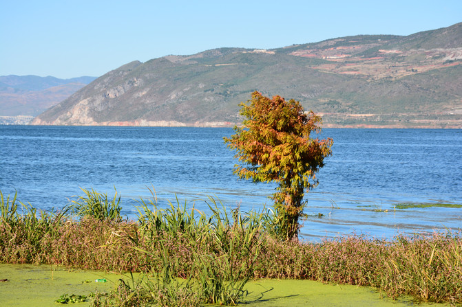
Dali-Erhai Lake(Photo taken in autumn 2017)
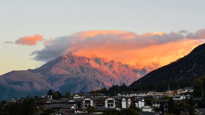
Lijiang-Yulong Snow Mountain(Photo taken in autumn 2011)
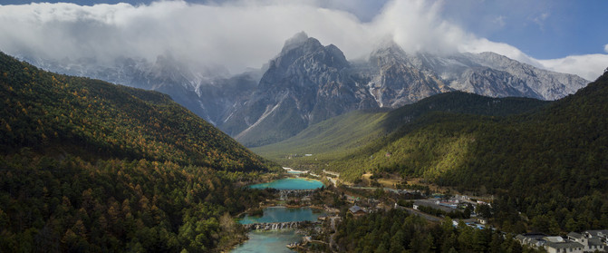
Lijiang-Lanyue Valley(3100 meters above sea level, photographed in the autumn of 2020)
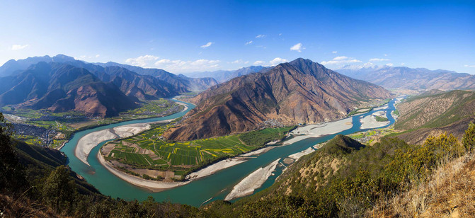
Lijiang-First Bay of Yangtze River(1850 meters above sea level, photographed in the autumn of 2017)
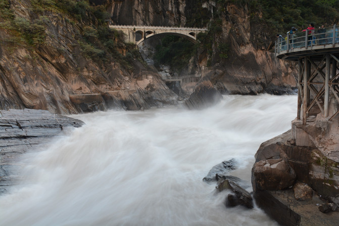
Lijiang-Tiger Leaping Gorge(1800 meters above sea level, photographed in the autumn of 2017)
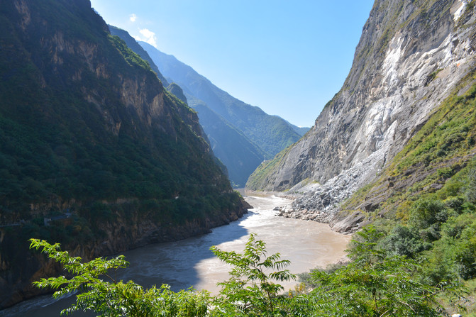
Shangri-La-Jinsha River Grand Canyon(1800 meters above sea level, photographed in the autumn of 2011)

Shangri-La-Balagzon(5545 meters above sea level, photographed in the autumn of 2017)
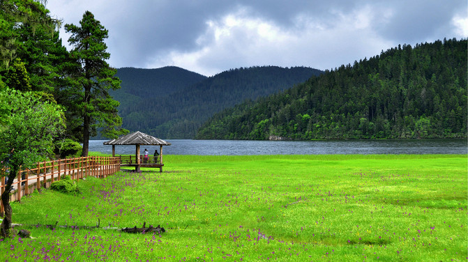
Shangri-La-Napahai(3266 meters above sea level, photographed in the summer of 2016)

Shangri-La-Baishuitai(2380 meters above sea level, photographed in the summer of 2016)
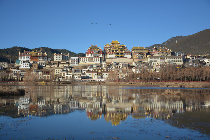
Shangri-La-Songzanlin Temple(Photo taken in the autumn of 2020)

Shangri-La-Shika Snow Mountain(4500 meters above sea level, photographed in the autumn of 2020)

Deqin County-Jinsha River Bay(2200 meters above sea level, photographed in the autumn of 2017)

G214/Dian-Tibet Line-benzilan town(2108 meters above sea level, photographed in the autumn of 2017)
G21/Yunnan-Tibet Line-Dry Hot Valley (

G214/Dian-Tibet Line-Baima Snow Mountain(5640 meters above sea level, photographed in the spring of 2014)
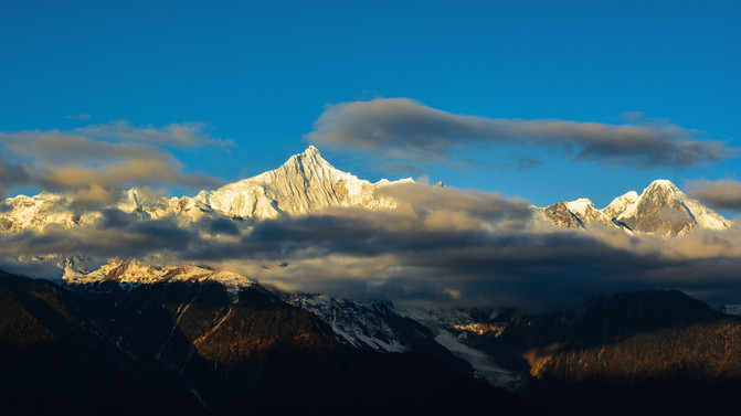
Deqin County-Meili Snow Mountain-Kawagbo Peak(6740 meters above sea level, photographed in the spring of 2014),The highest peak in the Yunling Mountains

Meili Snow Mountain-Wuguanfeng(5,470.5 meters above sea level, photographed in the spring of 2014)
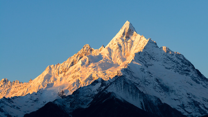
Meili Snow Mountain-Myantzm Peak(6,054.6 meters above sea level, photographed in the spring of 2014)

Meili Snow Mountain-Bujiong Songjie Wuxue Peak(Left, 6000 meters above sea level)&Sixteen Venerable Peak(Right, 5880 meters above sea level)
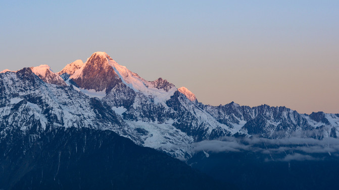
Meili Snow Mountain-Mabing Zhalawangdui Peak(6365 meters above sea level, photographed in the spring of 2014)
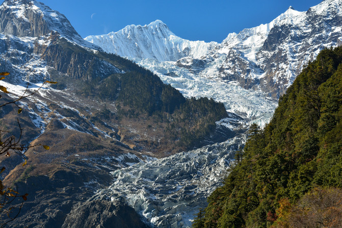
Meili Snow Mountain-Mingyong Glacier(4800 meters above sea level, photographed in the spring of 2014)

Meili Snow Mountain-Lancang River Meili Grand Canyon(Elevation 2006 meters, photographed in autumn 2020)

Fugong County-biluo Snow Mountain(4379 meters above sea level, photographed in the autumn of 2020)
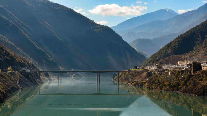
Dewei Line-Lancang River(2258 meters above sea level, photographed in the autumn of 2020)
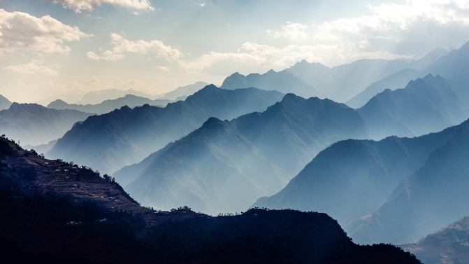
Lushui County-Gaoligong Mountain Reserve(Photo taken in the spring of 2014)
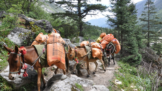
Lushui County-Nujiang Tea Horse Ancient Road(Photo taken in the summer of 2016)

Gongshan County-Bingzhong Luo-Nujiang First Bay(Photo taken in the spring of 2014)

Gongshan County-Bingzhongluo-Wuli Village(Photo taken in the summer of 2016)
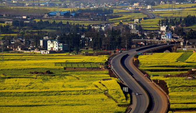
Luoping County-rape field(Photo taken in the spring of 2014)
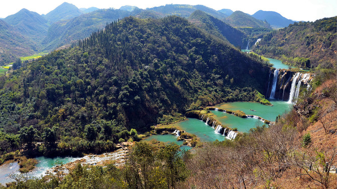
Luoping County-Jiulong Waterfalls(Photo taken in the spring of 2014)

Kunming City-Dongchuan Hongtidi(Photo taken in the spring of 2014)

Xuanwei City-Umeng Mountains(Photo taken in the summer of 2020)
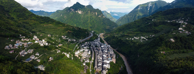
Yanjin County-Dousha Ancient Town(Photo taken in the summer of 2021)
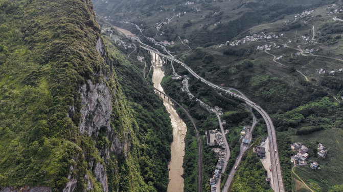
Yanjin County-Five-foot Road-Hanging Coffin of the Man(Photo taken in the summer of 2021)

Yanjin County-Guan River, Wumeng Mountains(Photo taken in the summer of 2021)
[Gansu Qinghai-Tibet Region]
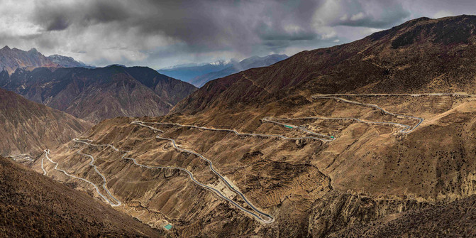
Xizang-Changdu City-Nujiang Turn 72(4618 meters above sea level, photographed in the autumn of 2014)

Xizang-Mangkang County-Maoya Grassland(3780 meters above sea level, photographed in the autumn of 2014)
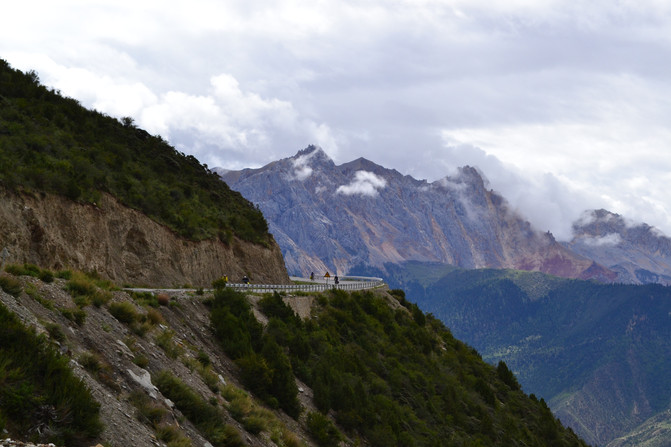
Xizang-Basu County-Yela Mountain(4658 meters above sea level, photographed in the autumn of 2014)
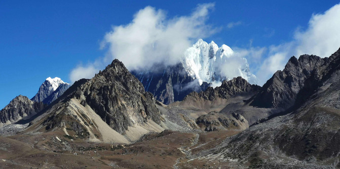
Xizang-Mangkang County-Daimiyong Snow Mountain(6434 meters above sea level, photographed in winter 2019),The main peak of the Tannantaweng Mountains
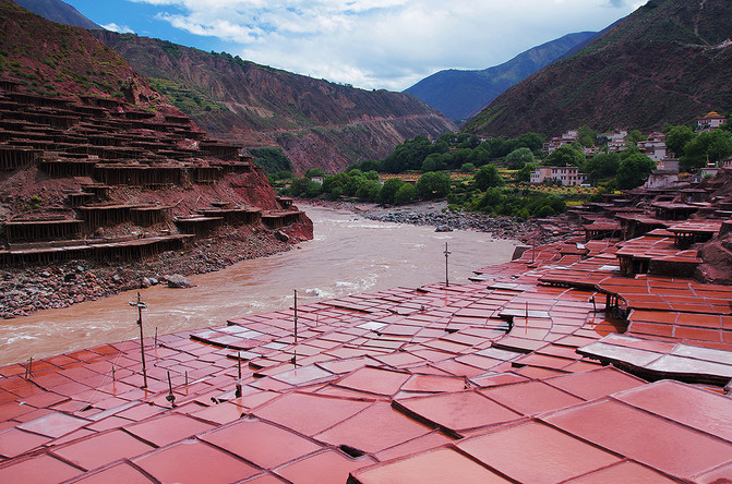
Xizang-Mangkang County-Yanjing(2400 meters above sea level, photographed in the summer of 2013)
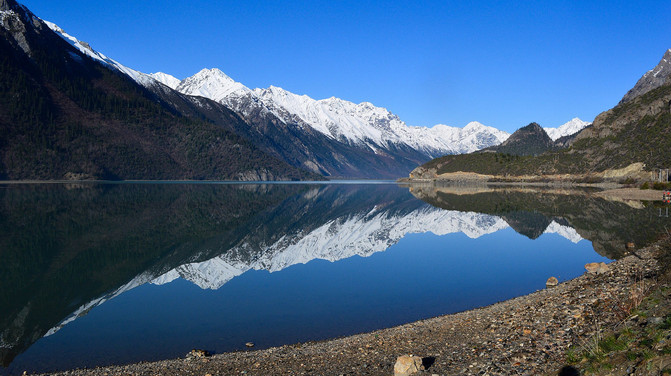
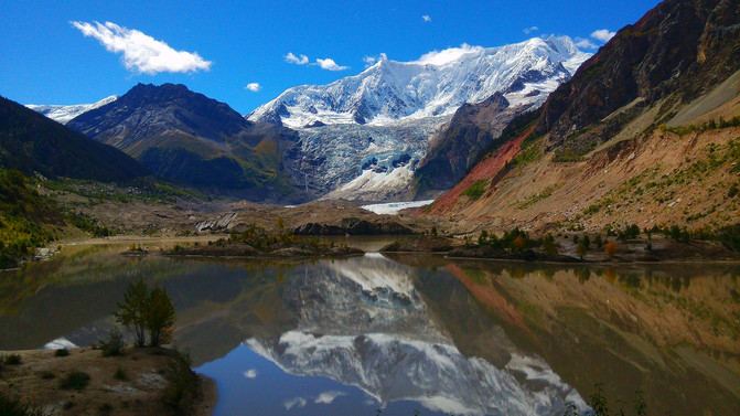
Xizang-Basu County-Ranwu Lake(3850 meters above sea level, photographed in the summer of 2013)
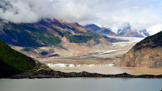
Xizang-Basu County-Meixi Glacier(4200 meters above sea level, photographed in the summer of 2013)
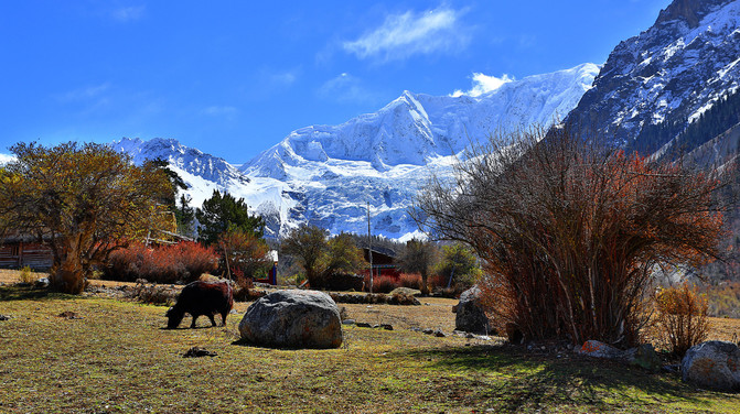
Xizang-Basu County-Laigu Glacier(4200 meters above sea level, photographed in the summer of 2013)
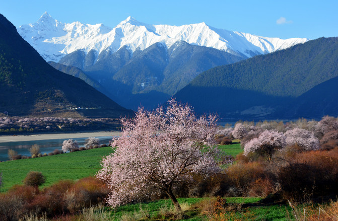
Xizang-Nyingzhi-Yarlung Zangbo Canyon(2880 meters above sea level, photographed in the spring of 2018)
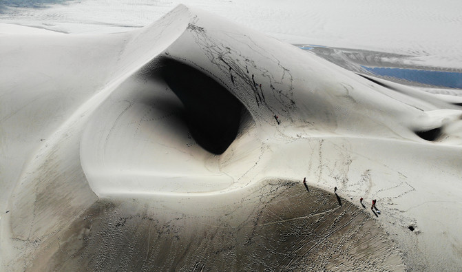
Xizang-Nyingzhi-Fozhang Sand Dune(3100 meters above sea level, photographed in the spring of 2018)

Xizang-Nyingzhi-Niyang River(2727 meters above sea level, photographed in the spring of 2018)
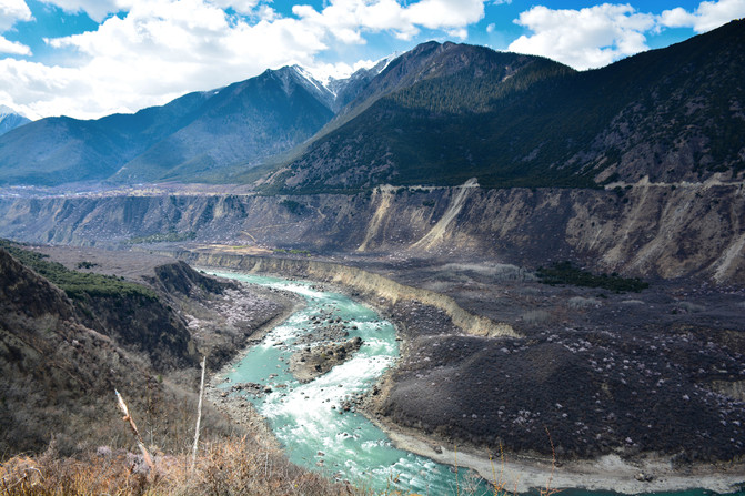
Xizang-Nyingzhi-Yarlung Zangbo River(Taken in the spring of 2018)
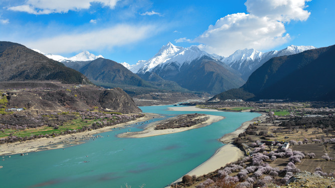
Xizang-Nyingzhi-Garabei Peak(7294 meters above sea level, photographed in the spring of 2018)
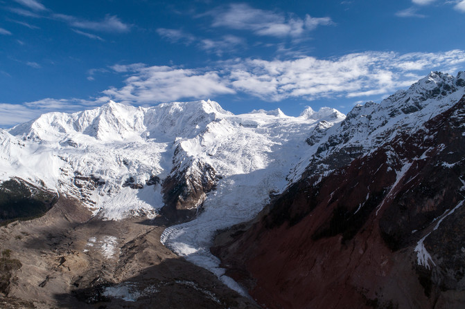
Xizang-Bomi-Midui Glacier(6800 meters above sea level, photographed in the spring of 2018)

Qinghai-Jiuzhi County-Lianbao Yeze(4000 meters above sea level, photographed in the summer of 2013)

Gannan Tibetans-sangke grassland(3000 meters above sea level, photographed in the summer of 2013)
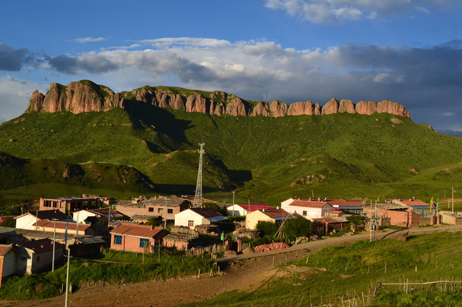
Gannan Tibetans-Red Cliff(3337 meters above sea level, photographed in the summer of 2013)
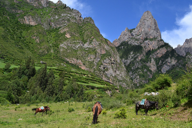

Gannan Tibetans-of zagana(4000 meters above sea level, photographed in the summer of 2013)
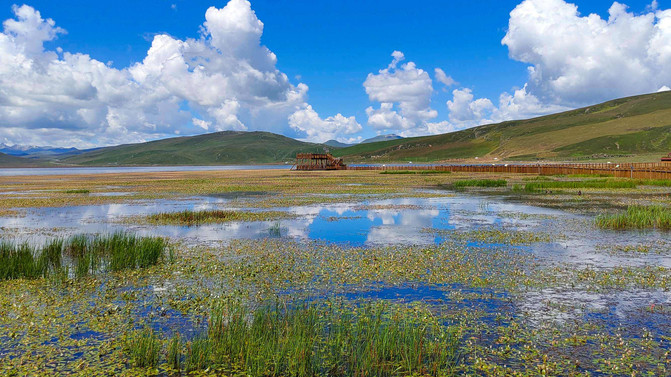
Gannan Tibetans-gahai(3200 meters above sea level, photographed in the summer of 2013)
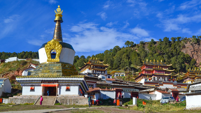
Gannan Tibetans-langmu temple(3670 meters above sea level, photographed in the summer of 2013)
The seven veins and six rivers in the Hengduan Mountains are majestic and are the ultimate treasures in the natural landscape.
In this vast mountain, countless beautiful scenery such as mountains and canyons, snow-capped glaciers, grasslands and wetlands, forests and lakes are like dazzling gems scattered among the mountains.
Over the years, aircraft, self-driving, and walking have penetrated deeply into it. No matter which way you enter, the geographical names in the books have become visible one by one. When dreams shine into reality, faith has power.
Previous Article:Recommended by indigenous people in Chengdu, full guide to the classic four-day and three-night itinerary (with food guide)
Next Article:Chengdu Qingcheng Mountain + Du Fu Cottage 5-day free travel guide in summer
