Journey to Glacier and Snow-capped Mountains--Half Moon Tour in Western Sichuan Small Ring Road
After a year of planning, the route for this year's trip to western Sichuan was finally determined before departure. This year's schedule was relatively loose. We finally decided to start the trip to the Western Sichuan Small Ring Road from Chengdu, then stop by to the Black Valley and Jinfo Mountain in Chongqing, and then return from Chongqing to Tianjin. Due to the many uncertain factors in the road conditions on the Western Sichuan Ring Road, only round-trip air tickets and train tickets from Chengdu to Chongqing were booked for this trip, as well as tickets for several must-see attractions. Tickets and transportation for other attractions were temporarily booked on the road.
The total cost (2 people) is 15,328.10 yuan, including: Airfare from Tianjin to Chengdu, Chongqing to Tianjin is 3,461.00 yuan, train ticket from Qingcheng Mountain to Chengdu to Shapingba is 309.00 yuan, fare from the Western Sichuan Small Ring Road is 868.00 yuan, fare from Hailuogou to Danba is 1,000.00 yuan, fare from Shapingba to Wansheng to Nanchuan to Chongqing is 200.00 yuan, round-trip fare from various scenic spots to accommodation is 212.00 yuan, and the total for 16 days of accommodation is 3,226.00 yuan. Tickets for scenic spots (including sightseeing buses and cableways) total 2,789.20 yuan, and meals, city fares, shopping and miscellaneous items are 3,262.90 yuan.
D1
Dujiangyan and Qingcheng Mountain are must-see places to visit when visiting Chengdu. We also chose Dujiangyan for our first stop in Chengdu. The plane landed in Chengdu last night and booked a through train from Chengdu Shuangliu Airport to Dujiangyan at 7:30 this morning. Arriving at the airport early in the morning, after some trouble, I finally found the place to get on the bus. About an hour later, the car arrived at the entrance of Dujiangyan Scenic Area. After picking up our tickets and storing our luggage at the Tourist Service Center, we started this year's journey.
Dujiangyan is a large-scale water conservancy project organized and built by Li Bing and his son on the basis of the excavation of Bieling by his predecessors. It consists of water diversion fish mouth, flying sand weir, treasure bottle mouth and other parts. It has been playing the role of flood control and irrigation for more than 2,000 years, making the Chengdu Plain A "land of abundance" with thousands of miles of fertile land, it is by far the world's oldest, only remaining, still in use, and characterized by water diversion without dams.
Entering from the gate, the first thing you can reach along the main road is Fulongguan. Here, you can see the rapid flow of Minjiang River water flowing into Baopingkou. It can not only irrigate the large tracts of fertile farmland in the east, but also reduce the flow of the river in the west, so that the river in the west will no longer flood. Next, continue to move forward along the main road, pass a rope bridge and reach the other bank. You can clearly see the mouth of the treasure bottle and the pile.
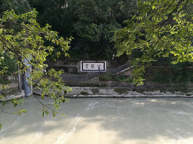
baopingkou

Treasure Bottle Mouth and Lidui
Continuing through Feisha Weir, we arrived at Yuzui, which is a key project of the Dujiangyan Water Conservancy Project. The completion of Yuzui divided the surging Minjiang River water in the upper reaches into two, forming the "Four-Six Dividing Water", which not only ensured the production and domestic water supply of the Chengdu Plain, but also protected the Chengdu Plain from flooding. Not far from the viewing platform at Yuzui is the Anlan Cable Bridge. After passing through the Anlan Cable Bridge and climbing the Qinyan Tower, you can see the full view of the Dujiangyan Water Conservancy Project.
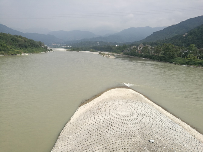
yuzui
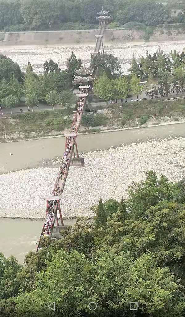
Anlan Suoqiao
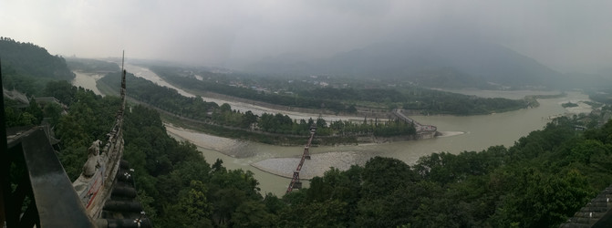
Full picture of Dujiangyan
Coming down from Qinyan Tower, passing through Erwang Temple and other scenic spots, we arrived at a small commercial street, where we had lunch. Crossing the commercial street and coming out of the South Bridge is the visitor center. In order to visit the back mountain of Qingcheng the next day, we booked an inn in Qingchengshan Town, picked up our luggage, and took the bus to Qingchengshan Town at the bus stop not far from the scenic spot. Arriving at the inn, it was still early, so I decided to go to the front mountain of Qingcheng Mountain to have a look.
Qingcheng Mountain is divided into front and back mountains. Qianshan Mountain is the main part of Qingcheng Mountain Scenic Area, which is commonly referred to as Qingcheng Mountain. It is one of the four major Taoist mountains in China; the back mountain is outstanding for its natural scenery, with beautiful water, quiet forests and majestic mountains. It is a good place for hiking and leisure.
The inn is not far from Qianshan, and the lady owner enthusiastically drove us to the gate of the scenic spot. It is still a certain distance away from the gate of the scenic spot, so you need to take a sightseeing bus from the scenic spot. Most tourists come to Qingcheng Mountain to Qianshan, so there are many people here. Jianfu Palace is located just outside the gate of the scenic area. Although the Taoist temple is not large, it is quite famous. Entering the scenic spot, I wanted to climb the mountain, but there were many people. I chatted with tourists going down the mountain at a fork in the road and learned that it would take more than two hours to walk up the mountain. Due to time constraints, we decided to take the cableway up the mountain.
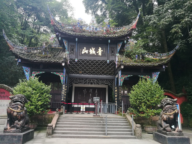
Qingcheng mountain

jianfu Palace
Not far up from the cableway station is Shangqing Palace, the core attraction of Qingcheng Mountain. We didn't know much about Taoist temples, and we didn't see anything about them. We walked around and came out. While drinking tea and resting in a tea shed not far below the Shangqing Palace, I learned that the scenery was better than in front of the Shangqing Palace by bypassing the Shangqing Palace and going down the mountain road behind it. So I decided to return again, go out through the door of the small courtyard on the side of the Shangqing Palace, and go down the mountain road behind it.

shangqing Palace
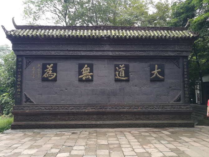
shangqing Palace
There are many Taoist temples on this road, including Ancestral Hall, Yuanming Palace, Yuqing Palace, Chaoyang Cave, Tianshi Cave, etc. on this road. The scenery is also better than in front, but the mountain road is very steep and not easy to walk. After stopping and stopping all the way, after more than 2 hours, we arrived at the fork we had passed before, that is, the place where we took the cableway up the mountain, and further down was the gate of the scenic spot. It was already past six o'clock and there were very few tourists. When I came out of the scenic area, I called the innkeeper to pick us up.

Taoist temple in Qingcheng Mountain

Taoist temple in Qingcheng Mountain
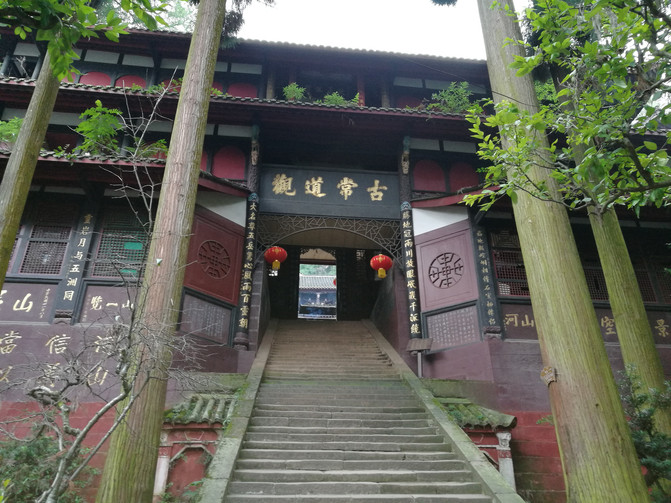
Taoist temple in Qingcheng Mountain

Taoist temple in Qingcheng Mountain
Back at the inn, after a simple meal, he rested early and prepared for the next day's trip to the back mountain of Qingcheng.
D2
After having breakfast at the inn in the morning, the landlady took us to the Qingcheng Mountain High-speed Railway Station, where there is a mini bus to the back mountain of Qingcheng. As soon as we arrived at the high-speed railway station, a driver came to pick up passengers. The price was 2 yuan/person more expensive than taking a minibus. It was an off-road vehicle. There were already two people on the bus. We could set off immediately after getting on the bus, so we decided to take an off-road vehicle to Qingcheng Mountain. I previously saw on the Internet that the back mountain of Qingcheng consists of Wulong Gully and Feiquan Gully. Talking with the driver in the car, I learned that the scenery up the mountain from Wulonggou is better, but you need to take a sightseeing bus from the gate of the scenic area to Wulonggou. Finally, we negotiated with the driver and he would drive us to the entrance of Wulonggou. The fare and ticket were 100 yuan/person.
Wulong Gully has a total length of 8 kilometers. It is named after the legend that there were five dragon dragons hidden in the ditch in ancient times. After getting off the bus at Wulonggou, you can directly enter the scenic spot. Since this is not a travel agency tour route, there are very few people. At this time, it began to rain, and the mountains were covered in a layer of fog, making it even more peaceful. After passing a small bridge, you can see the gurgling water. Going upstream, there are peaks and peaks, and the rocks are high and the valleys are deep. Between the blue peaks and valleys, it is like a magical and magnificent celestial mountain scenery. There are streams along the way, and the quiet valley allows us to stop and watch from time to time. After passing through the Longyin Gorge plank road, we arrived at another village. It was already noon. There are many farmhouses here. We had lunch here and took the cableway up the mountain. The cableway from Youyi Village to Baiyun Temple passes through several peaks. The cableway keeps climbing between the peaks and valleys. You can see that different scenery between the peaks and valleys change alternately. The peaks are shrouded in clouds and clouds, and the trees are green in the valleys. After more than 20 minutes, I came to the Baiyun Temple cableway station.

Qingchenghoushan

Qingchenghoushan
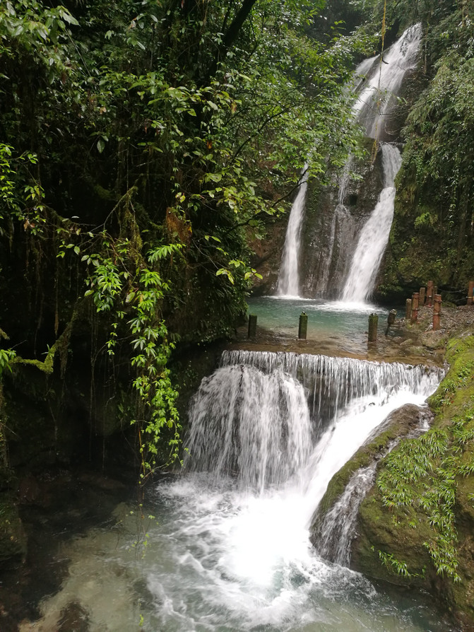
Qingchenghoushan

Qingchenghoushan
To reach Baiyun Temple, it takes more than an hour to stand up from the Baiyun Temple cableway. In order to conserve our strength, we decided to give up Baiyun Temple and go down the mountain through Feiquangou. It drizzled and stopped sometimes along the way, and the road was relatively slippery. After passing through large and small mountain waterfalls, we arrive at Cuiying Lake. You can take a boat from Cuiying Lake back to the gate of the scenic area.

Qingchenghoushan

Qingchenghoushan
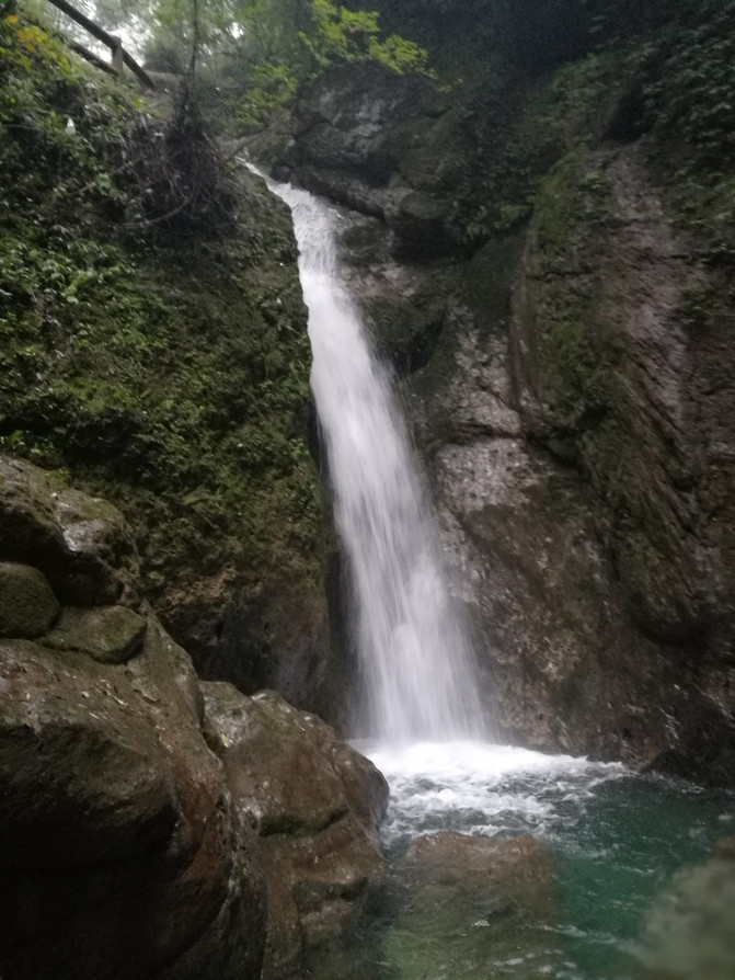
Qingchenghoushan

Back Mountain of Qingcheng-Cuiying Lake
Coming out of the back mountain of Qingcheng is the ancient town of Tai 'an, an important transportation hub in ancient times. Passing through the town, there are ancient wooden buildings on both sides of the street, with high and low patterns, and the ancient charm still remains.
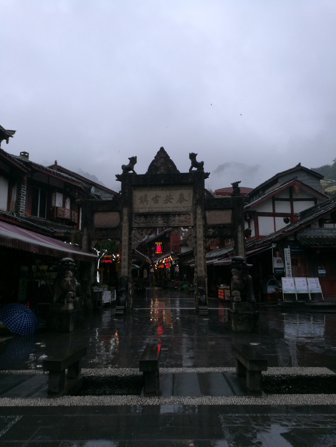
tai 'an Old Town
After tasting the local specialty tofu pudding rice in the town, take the bus back to Chengdu and get off at the Qingchengshan High-speed Railway Station and return to the inn.
D3
Having ended our trip to Qingcheng Mountain, today we are going to the next stop-Hailuogou.
There is a direct bus from Chengdu Xinnanmen Passenger Station to Hailuogou. Since we wanted to see Luding Bridge, we chose to transfer from Luding to Hailuogou. Take the high-speed train from Qingcheng Mountain to Xipu at 6:55 in the morning, arrive at Xipu Station in half an hour, transfer to Metro Line 2 to Chengdu Chadianzi Passenger Station. At 9 a.m., the bus left on time and arrived at Luding Bus Station after 5 hours.
Luding Bridge is not far from Luding Bus Station. After storing our luggage at the station, we walked to Luding Bridge.
Luding Bridge is located on the Dadu River. It was built during the Kangxi period of the Qing Dynasty. There is an imperial plaque "Luding Bridge" inscribed on the bridge of the bridge with Kangxi's imperial pen. The Qiaotou Castle on both sides of the Luding Bridge is an ancient wooden structure building of the Han nationality, and the abutment is the foundation for fixing earth dragon piles and Wolong piles; the bridge pavilion is an ancient Qing-style building. The bridge body consists of 13 iron chains as thick as a bowl, two on each side, which are bridge railings, and nine are side by side at the bottom, and are paved with wooden boards to form the bridge deck. Each chain is fastened by 862 to 997 hand-made wrought iron rings, with a total weight of 21 tons. The bottom chain is covered with wooden boards, and the handrails and the bottom chain are connected with small iron chains. Since the Qing Dynasty, this bridge has been an important passage for Sichuan to enter Tibet. In 1935, the Chinese Workers 'and Peasants' Red Army "flew over the Luding Bridge" during the Long March, making it an important historical memorial site for the Communist Party of China.
Although the bridge is now paved with wooden boards, standing on the rickety bridge and looking at the surging Dadu River water flowing under the bridge will make people shudder. Imagine what a feat it was for 22 warriors to bravely climb over the iron chain despite the enemy's hail of bullets. Standing on the Guanyin Pavilion on the other side of the bridge, you can see the entire view of Luding Bridge. The artillery support when the Red Army "flew over the Luding Bridge" was set up on a small platform in Guanyin Pavilion.

luding bridge
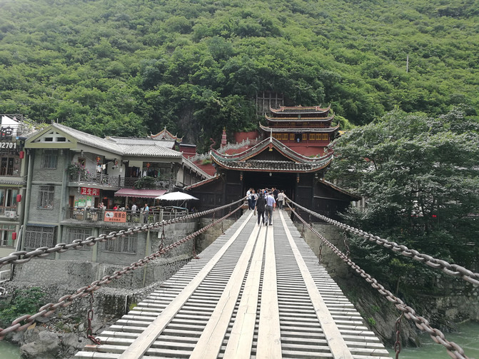
luding bridge
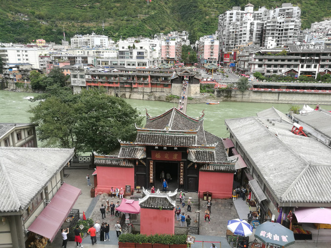
luding bridge
When I came back from Luding Bridge, I bought the unique fruit "Xiantao"-the fruit of cactus. Arriving at the bus station, we just caught a car heading for Moxi Town and was ready to drive. An hour later, we arrived at Moxi Town, the location of Hailuogou.
There are many inns in Moxi Town. Guests who come to Hailuogou for tourism can stay here. Accommodation and accommodation are relatively convenient, but if you want to soak in the hot springs, you have to go near Camp No. 1 in the scenic area. If you don't drive yourself, it will be inconvenient. The hot springs in Hailuogou are very famous. We booked an inn in the scenic area where we can soak in the hot springs. After arriving in Moxi Town, we called the innkeeper and drove us to the inn.
The inn is located in Gonghe Village near Camp No. 1. Taking advantage of the spare time when the landlady was preparing dinner for us, we walked around the village. This village is a very simple village. There are many farmhouses in the village, and the villagers are also very simple. Back at the inn, after dinner, the boss had prepared a pool of hot spring water for us. Soaking in the hot spring water with a faint smell of sulfur relieves the fatigue of the day.
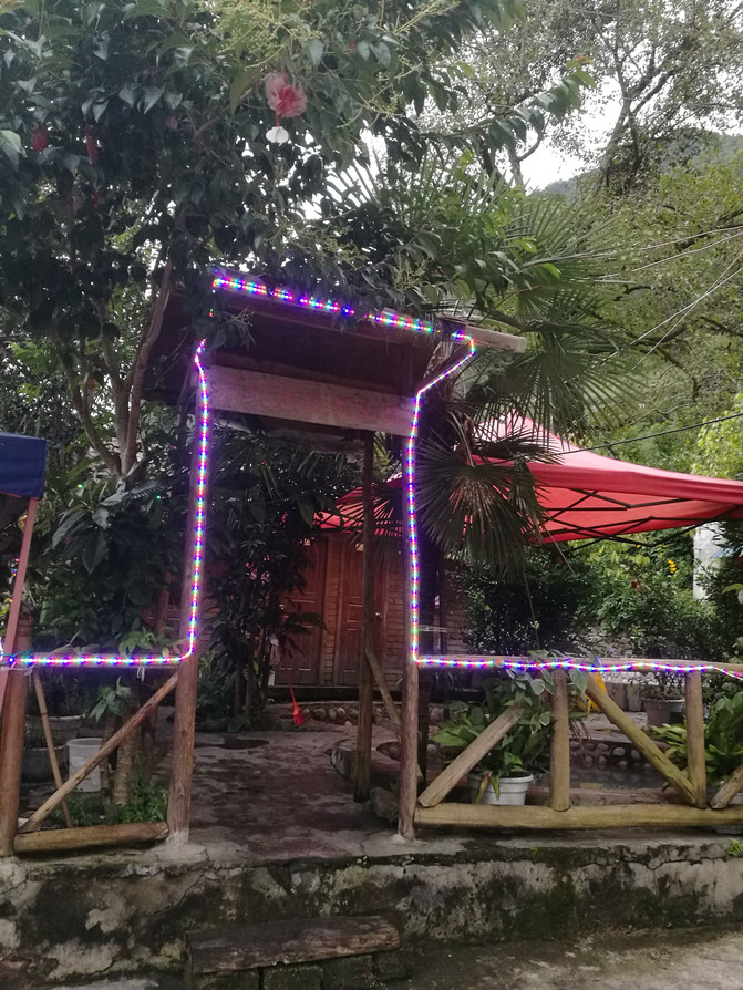
Qingquanju Hot Spring Mountain Villa

Qingquanju Hot Spring Mountain Villa
D4
The sightseeing bus from the scenic area passed near the inn where we stayed, and the inn owner had booked seats for the sightseeing bus for us in advance. After breakfast, the boss took us to the sightseeing bus on the road and waiting for the scenic spot. Today, we will officially start our glacier journey.
Hailuogou is located at the foot of Gongga Snow Peak and is the easternmost low-altitude modern glacier discovery site in Asia. It has the most accessible glaciers in the world, the most majestic ice waterfalls, the most complete mountain vegetation belt, the largest red stone beach and a strong ethnic customs. Hailuogou Glacier is the most active. During the movement of the glacier, glacier arcs, ice caves, ice ladders, ice gates, ice lakes, and ice peaks that are crystal clear like jade and crystal are formed. The world's unparalleled Big Ice Waterfall is more than 1000 meters high and about 1100 meters wide. It is more than ten times larger than the famous Huangguoshu Waterfall. It is magnificent and is the highest Big Ice Waterfall discovered so far in China.
Camp No. 4 is the best place to view the Dabing Waterfall. It was raining when we set off and the fog on the mountain was very heavy. We were worried that we wouldn't see the Dabing Waterfall when we reached the mountain, so we decided to go to the gate hole located in Camp No. 3 first. After an hour's drive, we arrived at Camp No. 3. Most tourists come to Hailuogou to see the Dabing Waterfall, so we are the only ones who get off at Camp No. 3.
There are battery trucks that can reach you from Camp No. 3 to Chengmen Cave, but we arrived too early and the staff had not yet gone to work. After asking the staff, we learned that Camp No. 3 was only 1.5 kilometers away from Chengmen Cave, so we decided to go there on foot. There were dense trees on both sides of the road, and there were only the two of us along the way. We breathed the moist and fresh air to our heart's content on the road. Halfway through, we saw the snowy mountains in the distance, looming in the misty clouds. This was the first time I saw a snowy mountain and I was immediately excited.

Hailuogou-Snow Mountain

Hailuogou-Snow Mountain
When we were approaching Chengmen Cave, we met a staff member and asked about it that for safety reasons, Chengmen Cave can only be viewed from a distance beyond the safety line and cannot be close to the glacier. But this staff member said that because there were no one now, he could lead the way for us and get close contact with the glacier, but he would have to be paid 50 yuan. After bargaining, he agreed to take us there for 30 yuan. After passing through a rocky mound, we finally arrived at the foot of the glacier and had a close contact with the glacier.
When you come to the glacier, you can see a moraine lake formed by glacier melt water. The water flow here is rapid and there are many ice cubes of different sizes in the lake. The glaciers in the distance reflect a bright blue color. The huge ice caves and steep ice bridges make people feel like entering the mythical crystal palace; the surface of the glaciers nearby is covered with a layer of sand and gravel, showing a gray white color. When you brush off the surface, you can touch the ice 1.6 billion years ago, and you can see the small bubbles in the ice surface. Due to global warming, it is said that the glaciers here are receding every year. This may be the negative impact that people have on nature while pursuing a comfortable life. If we want to protect these masterpieces of nature, I think we should start with ourselves and every bit of life.

Hailuogou-Chengmendong Glacier
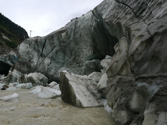
Hailuogou-Chengmendong Glacier

Hailuogou-Chengmen Cave Moraine Lake
We stayed near the glacier for a while, and after close contact with the glacier, we returned the same way. There was a small lake near the parking point where we returned to the battery car. The sky was clearing up. We saw the reflection of the snowy mountains in the lake. The gold and silver mountains complemented each other, making it spectacular.
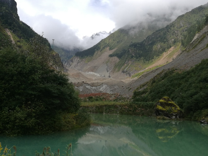
hailuogou
Coming back from Chengmen Cave, we continued to take the bus to Ganheba Station, where we could take the cableway to Camp No. 4 to watch the Big Ice Waterfall. The cableway passes over the glacier. Sitting in the carriage, you can clearly see that there are many ice cracks on the glacier at the bottom of the valley, and the rocks on the mountains on both sides have been polished smooth and round by the glacier. The glacier tongue here extends into the virgin forest for up to 6 kilometers, forming a unique landscape where glaciers and forests coexist. As you approach Camp No. 4, you can see crystal glaciers pouring down from the high valley, decorating the silent valley into a clear and clear Qionglou and jade space.
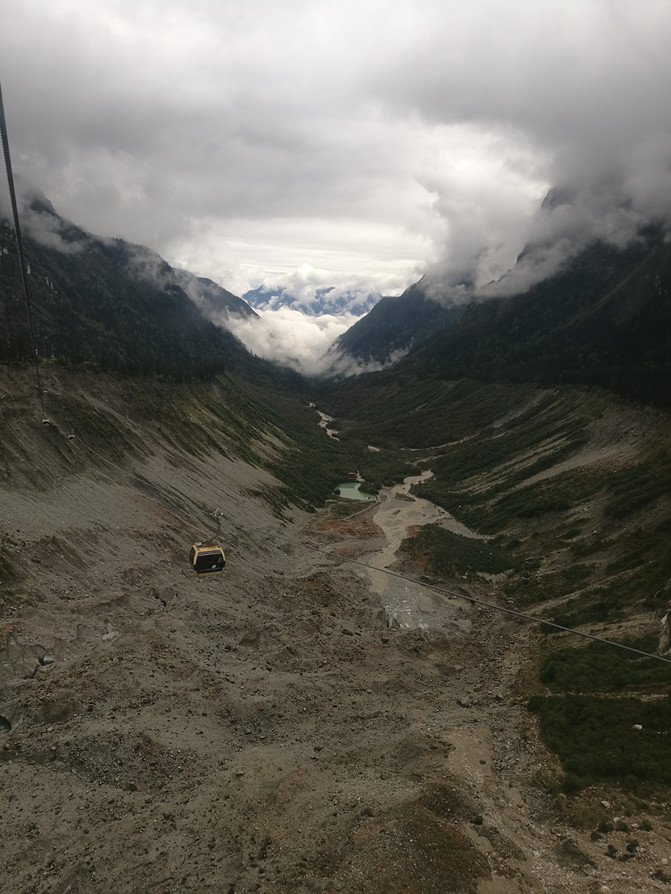
Glacier viewing from cableway

Glacier viewing from cableway
Hailuogou Glacier, also known as the No. 1 Glacier, has a total length of 14.7 kilometers. It is the longest glacier in the Gongga Mountains. The Dabing Waterfall is the tallest and most spectacular glacier waterfall discovered so far in China. In Camp No. 4, you can have a close view of the Big Ice Waterfall. Behind the Big Ice Waterfall is the majestic main peak of Gongga Mountain. It is said that on the mountainside of the magnificent Ice Waterfall, a powerful snowy mountain demon wolf with its head held high is lifelike, which is extremely mysterious and shocking. We stayed on the viewing platform for more than two hours. The clouds gathered and dispersed from time to time. The ice waterfalls changed from time to time in the light and shadow of the clouds and clouds, presenting different landscapes. Due to too much fog, we were never able to see the main peak of Gongga Mountain and the wonder of the "Wolf Totem".

Hailuogou-Dabing Waterfall
After getting off from Camp No. 4, we took a bus and got off at a place called Dongga Temple. I thought it was a temple, but after getting off the bus, I only saw Buddha murals carved on the mountain wall by the roadside and some prayer wheels. It turned out that this place was just a place name and there was no temple. From here, we could walk to Caohaizi, which was about 1 kilometer away. We decided to walk to Caohaizi. There are virgin forests along the way, lush vegetation, moss is covered on the ground, and trees are covered with a plant called Urea. Usnea is a kind of lichen plant that has extremely high requirements for its growth environment and can only survive in a non-polluted environment.

Hailuogou-Dongga Temple
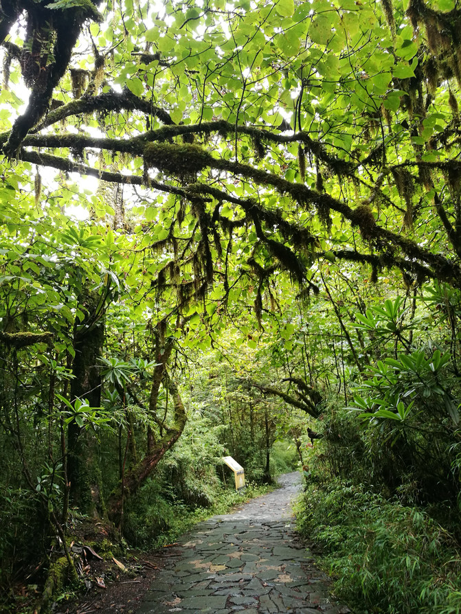
Hailuogou--Usnea caohaizi
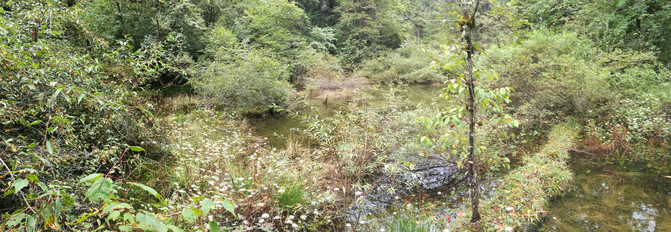
Hailuogou-Caohaizi
After coming out of Caohaizi, take a sightseeing bus back to the inn. It started to rain again. In the patchy rain, soaking in the hot springs washed away the fatigue of the day.
D5
I originally planned to go to Kangding after visiting Yanzigou today, and charter a car from Kangding to Danba tomorrow. During chatting with the innkeeper, I learned that we could also reach Danba in one day from Hailuogou, so I asked the innkeeper to contact us with the chartered car for Danba, and the innkeeper readily agreed. After breakfast, the innkeeper personally drove us to Yanzigou Scenic Area.
Yanzi Gully is the sister ditch of Hailuogou, located more than 10 kilometers northwest of Hailuogou. The scenery in the ditch is primitive and natural, and strange red rocks are scattered all over the Hongshi Beach, also known as the "Gongga Red Rock Valley". The Yanzigou Scenic Area is surrounded by modern glaciers, forests, mountains, warm waters, cold springs, rare animals and plants. The simple and beautiful natural ecological landscape has formed her unique charm.
It takes about 20 minutes from Moxi Town to Yanzigou Scenic Area. Since it is not as famous as Hailuogou, not many people come here. From the tourist center of the scenic spot to the scenic spot, we need to take a scenic spot sightseeing bus. We and several other tourists who drove here took the sightseeing bus to the scenic spot. The road conditions are not very good, the road surface is potholes, and traces of mudslides can be seen from time to time. After about half an hour, we reached the Ten Mile Wonderland Scenic Area. From here, you can walk through a flight of stone steps to Diecui Pavilion, and then walk along the pedestrian plank road to Hongshi Beach.
We walked up the stone steps. On one side of the mountain wall was the prayer wheel and on the other side was the waterfall stream. After passing through the Diecui Pavilion, enter the pedestrian plank road. There are dense forests everywhere, and the moss covered paths lead to the depths of the dense forest. The misty mountains in the distance and the silent mountains and forests nearby give people a feeling of tranquility and tranquility. People walking among them, breathing the fresh and humid air, and listening to the chirping of birds from the dense forest, making people forget the troubles of the world and feel like they are integrated with nature. There was a section of the pedestrian plank road that was washed away by mudslides, and a temporary path was built next to it for tourists to pass through. The place where the mudslides passed was covered with silt, and broken trees fell to the ground. The vegetation had not yet fully recovered, giving a sense of desolation.

Yanzigou Scenic Area-Shili Gallery
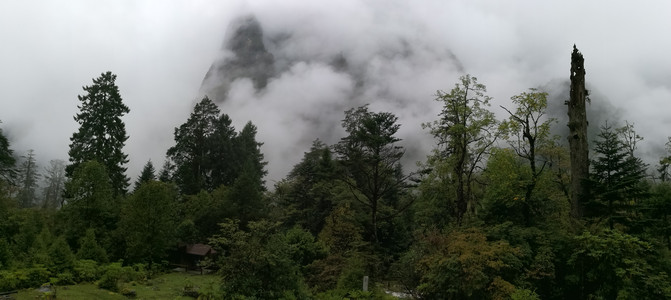
Yanzigou Scenic Area-Shili Gallery
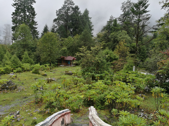
Yanzigou Scenic Area-Shili Gallery
Coming out of the Ten Mile Wonderland Scenic Area, you will find Hongshi Beach on the opposite road. In order to protect Red Rock, the road down to the valley bottom has now been closed. We met a local elder sister who peddled medicinal materials. Under her leadership, we had an intimate contact with Hongshi. The red stone here is a layer of red fungi attached to the surface of the stone. It has extremely strict requirements on the quality of the growth environment. Air cleanliness, humidity, and water cleanliness will affect his growth. The red rocks all over the Hongshi Beach are spectacular against the backdrop of the mountains and flowing water.
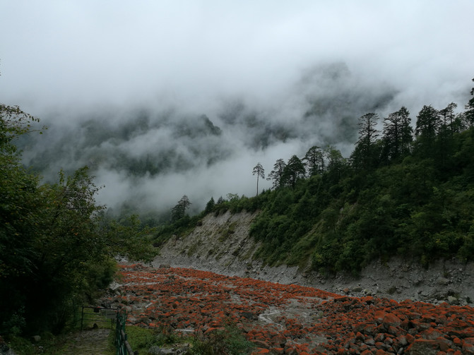
Yanzigou Scenic Area-Hongshitan

Yanzigou Scenic Area-Hongshitan
After coming out of Hongshitan, I returned to the Ten Mile Wonderland Parking Lot. Take a sightseeing bus from here and get off at Rock Ranch, where some yaks, alpacas and other animals are kept. I walked around inside, but it was not interesting. From here, I took a bus back to the visitor center. With the help of the visitor center staff, I found a car back to Moxi Town.
After getting off the bus in Moxi Town, it was still early and decided to take a stroll in Moxi Town.
Moxi Town has now become a prosperous town on the Sichuan-Tibet Corridor. The town retains many ancient buildings in the Ming and Qing Dynasties and a Gothic church built by French missionaries. The blend of Chinese and Western cultures has added another flavor to the ancient town. In 1935, 20,000 Red Army troops came here and held the famous Moxi Conference on the Long March. Here you can see the old residence where Chairman Mao Zedong stayed during the Long March. Walking on the old road paved with bluestone slabs feels like returning to the past. Nowadays, Moxi Town is mainly filled with inns and shops for buying local specialties and tourist souvenirs.

Moxi Town-Catholic Church
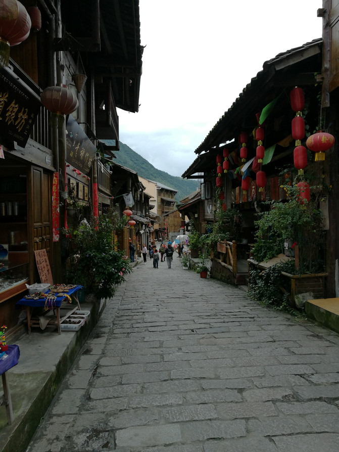
Moxi town
We walked around the town, visited the Catholic Church and the old residence where Chairman Mao Zedong stayed, and contacted the innkeeper on the phone to pick us up and back to the inn.
D6
Early this morning, the chartered driver we contacted came to the inn to pick us up. Today we will embark on a snowy mountain journey along National Highway 318.
The section of the road from Hailuogou to Danba is a scenic avenue, and many different scenery can be seen along the way. But most of them are by car, and there is very little time to visit scenic spots.
The first scenic spot we visited was Hongshi Park. It is said that on sunny days, you can see red rocks stretching for several kilometers here, which is still very spectacular. Due to the rain when we set off from Hailuogou in the morning, the fog was very heavy, so we could only see red rocks and running water nearby, and the mountains in the distance showed hazy silhouettes under the fog. We had already seen red rocks in Yanzigou yesterday. Coupled with the fog and low visibility, we just took a few photos here and left. The next attraction is Yajia Qinghai. We also stopped at the door for a while before leaving. Next, we had to climb the Zhuoduo Mountain at an altitude of 4200 meters.
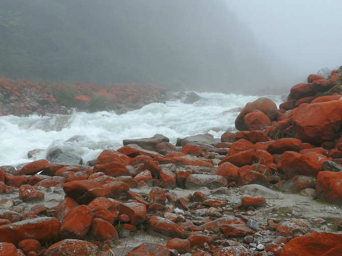
Red Rock Park in thick fog
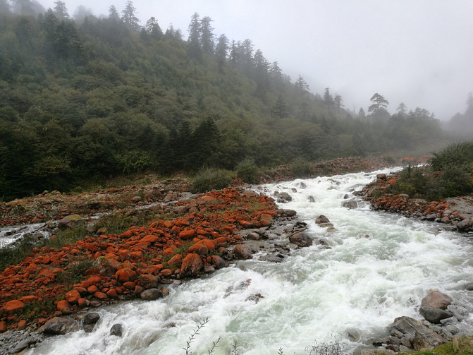
Red Rock Park in thick fog
On the way up the mountain, halfway up the mountain surrounded by clouds and mist, the snowy mountains shone brightly under the sunshine shining through the gaps between the clouds and mist. Against the backdrop of clouds and mist, the snowy mountains are half-hidden and half-visible, making them feel more mysterious. When we reached the top of Zheduo Mountain, the clouds and fog dispersed, and the sun shone on the surrounding snowy mountains and meadows, and the surrounding scenery was clearly presented in front of us. Climbing the observation deck at the top of Zheduo Mountain, you can see the majestic main peak of Gongga Mountain.
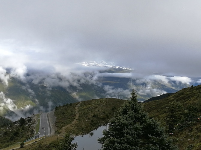
Scenery on the way to Zheduo Mountain
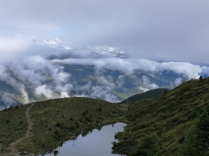
Scenery on the way to Zheduo Mountain
The main peak of Gongga Mountain is 7556 meters above sea level and is covered with snow all year round. It is the highest peak in the Hengduan Mountains in the southeastern Qinghai-Tibet Plateau. There are 45 peaks with an altitude of more than 6000 meters around the main peak. The majestic snow-capped mountains are continuous, majestic, clean and magnificent, creating a magnificent landscape of the extremely high mountains.
The road leading to the top of the mountain is covered with prayer flags. From here, we have entered the Tibetan area. This is also the highest altitude place we reached on this trip.

Zheduo Mountain Top
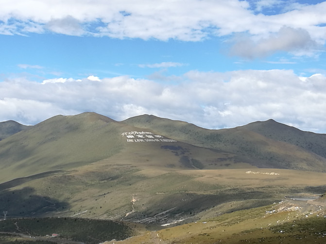
Zheduo Mountain Top

Zheduo Mountain Top
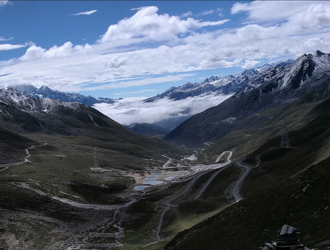
Zheduo Mountain Top
Coming down from the top of the mountain, accompanied by snow-capped mountains, we headed for Xinduqiao Road. As we approached Xindu Bridge, many Tibetan-style houses appeared on both sides. The vision was much wider, and the mountains on both sides presented different scenes amid the constant changes of light and shadow. At about 1 o'clock, we arrived at Xindu Bridge. After lunch here, we continued on our way.
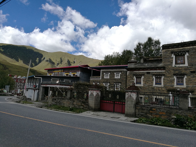
xinduqiao
Starting from Xindu Bridge, we passed a place called Songlinkou. There are many Mani stones engraved with scriptures in the river here, and murals are also carved on the mountain walls on both sides of the road, and prayer flags are hung everywhere, giving people a strong Tibetan flavor. We walked all the way, took photos all the way, and the next thing we arrived at was Tagong Temple.
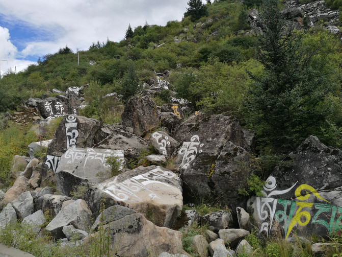
Songlinkou

Songlinkou
Tagong Temple is one of the famous temples of the Sakya School of Tibetan Buddhism. It is known as the "Little Jokhang Temple" and has a high status in Tibetan Buddhism. It is one of the holy places where Tibetans worship in the Kangba area. The temple architecture is spectacular and has an ancient and long history. When the weather is clear, you can see the resplendent Tagong Temple set off against the Yala Mountain behind it and the vast green grassland, presenting a beautiful plateau scenery. Unfortunately, when we came, thick clouds covered the Yala Mountain and we didn't see this beautiful and charming scenery.
The statue of Sakyamuni enshrined in Tagong Temple is said to have been sculpted by Princess Wencheng when she entered Tibet. Entering the temple, the outer wall of the hall is resplendent. The walls and high dome around the hall are filled with Thangka paintings, and the altar where Buddha statues are enshrined is filled with butter lamps. The lamas each went about their own things and were not disturbed by our arrival. There is no commercial atmosphere like some temples in the mainland here, only the majesty of Dharma. This was the first time I entered a Tibetan Buddhist temple, and I was immediately infected by this solemn feeling. There are narrow stairs on both sides of the main hall that lead to the second floor. The inside is filled with Thangka, and portraits of the living Buddha of the temple from generation to generation are enshrined. Coming out of the main hall, there are side halls on both sides, where Buddha statues are also enshrined, and Thangka are also hung on the walls.
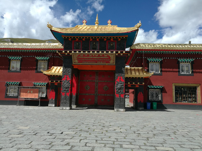
Tagong Temple

Tagong Temple
Not far from Tagong Temple is the entrance to Muya Golden Tower and Tagong Grassland. The Muya Golden Tower is a stupa built by the Living Buddha of Doji Tashi to commemorate the 10th Panchen Lama who instigated the foundation here. Due to limited time, we just took a photo at the door and left.
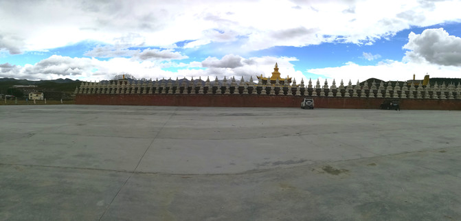
Muya Jinta
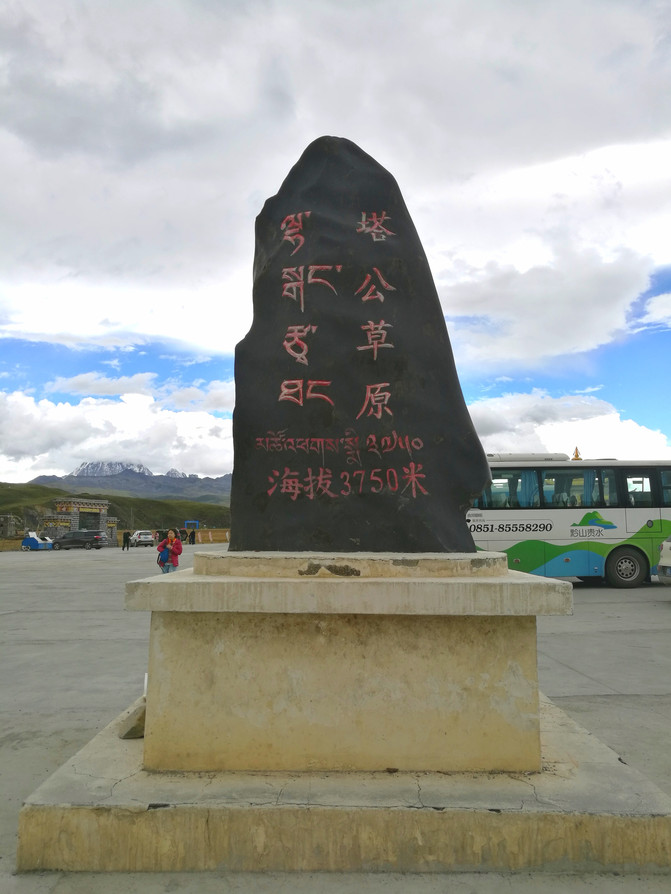
tagong grassland
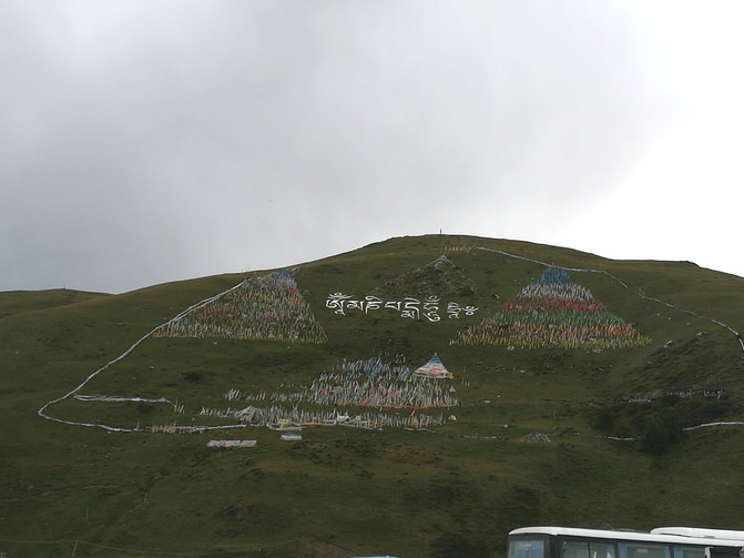
tagong grassland
The next attraction to visit is Moshi Park, which is also one of the attractions we plan to visit this time. Moshi Park Scenic Area is the only plateau stone forest landscape in China, but the driver said that it would take more than an hour to travel by sightseeing bus. Because we had to rush to Jiaju Tibetan Village to stay at night, we were afraid that there was no time, so we had to give up the visit to Moshi Park. Part of the Zhongtu Stone Forest in Moshi Park can be seen from a viewing platform by the road. We got off the bus and stayed for a while and took a few photos, which was to make up for the regret that we couldn't go in and visit.

Moshi Park
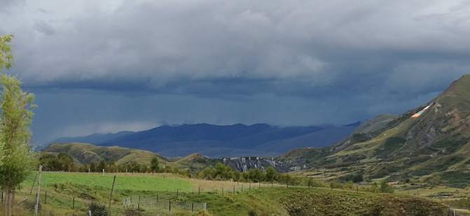
Moshi Park
At about 5 p.m., we arrived at Huiyuan Temple. Huiyuan Temple was built in the seventh year of Yongzheng of the Qing Dynasty. The Qing government allocated silver to ensure the security of the Seventh King and stabilize the situation in Xizang. The temple was built in a grand, unique and resplendent temple. In the middle of the temple gate hangs a huge gold-plated plaque of "Huiyuan Temple" awarded by Emperor Shizong of the Qing Dynasty. It was already past 5 o'clock when we arrived, and the main hall was closed. We only walked around the temple once before coming out.
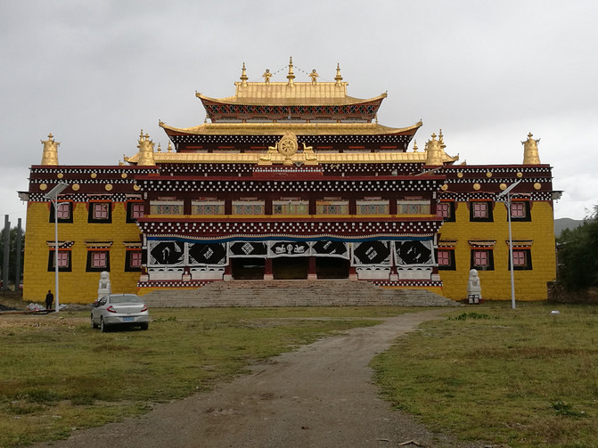
Huiyuan Temple
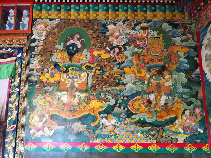
Huiyuan Temple
After 2 hours from Huiyuan Temple, we arrived at today's destination-Jiaju Zangzhai at 7 p.m.
D7
The inn we stayed in was a Tibetan-style dwelling located in the middle of Jiaju Tibetan village. It was already dark when I arrived yesterday, so I couldn't see the stockade. I visited the inn first morning this morning.
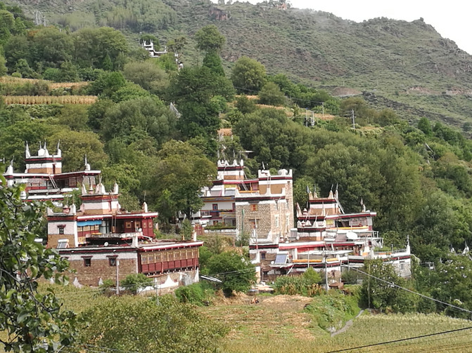
Jiajuzangzhai

Jiajuzangzhai
In the 2005 China beauty pageant organized by China National Geographic magazine, Jiaju Tibetan Village was rated first among the "Six Most Beautiful Rural Towns in China". "Jiaju", Tibetan means hundreds of households. There are more than 140 Jiarong Tibetan households living here. The Tibetan villages climb up from the Dajin River Valley to the foot of the Kapama Peak. Looking around, the entire village stretches along the undulating mountains, or dotted with stars, or densely concentrated, or on high mountains and cliffs, or among the greenery of river dams, cooking smoke curling and smoke lingering from time to time, together with the aura of valleys, clear streams, and capped snow peaks, the pastoral scroll is displayed in front of people. Existing in the form of a work of art.
After breakfast, we wandered around in the stockade. Jiaju Tibetan stockade is a unique Tibetan-style building. Each family here lives in a stockade building. Generally, stockpiled buildings face south, with three or five groups leaning against each other, while some are far away from the buildings and are independent. Many stockpiled buildings have a history of more than a hundred years. The residents here are very enthusiastic. We entered a stockade building and with the owner's permission, we visited the stockade building where they lived. The first floor of their stockade building is a storage place, the second floor is for people to live in, connecting different rooms through the roof, and the third floor is the scripture hall, which is the most sacred place in the entire stockade building. Generally, outsiders are not allowed to enter. Nowadays, when tourism is carried out, most villagers have built newly equipped houses next to their own stockade buildings to receive tourists, and they still live in the old stockade buildings.
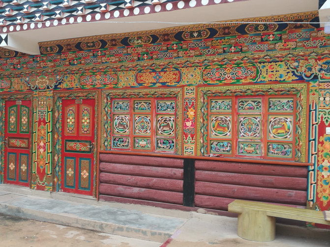
Jiajuzangzhai
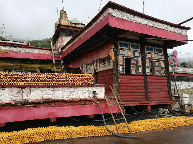
Jiajuzangzhai
The whole stockade was like a big maze. We walked around the stockade for a long time before we found the way back to the inn. The innkeeper said that we could hail a car at the entrance of the inn from Zhaizi to Danba County, but we stopped a few cars that were booked by others. We had to trouble the innkeeper to call a car for us at an agreed price of 40 yuan. But after getting on the bus, the driver said that he would only go to the entrance of the scenic area and would have to pay more to get to Danba County. In the end, he negotiated 70 yuan to send us to Danba County. On the bus, we asked the driver for the price of a chartered car from Danba County to Siguniang Mountain, and finally agreed to carpool us to the hotel in Changpinggou for 150 yuan per person. But after arriving in Danba County, the driver said that he would leave later, so he asked us to put our luggage on the car first and walk around the county city. There are many small shops selling ethnic jewelry in Danba County. We were just halfway through the tour when the driver called and said that everyone was here and we could go. We rushed back to the station and learned that the original driver was not going, so we asked us to take another off-road vehicle to Chengdu. As a result, nine people were crammed into a 7-seater off-road vehicle. Fortunately, it was only a 2-hour drive. At around 3 o'clock in the afternoon, we arrived at the hotel in Changping Village, Siguniang Mountain.
Siguniang Mountain belongs to the Qionglai Mountains of the Qinghai-Tibet Plateau. It is lined up within 3.5 kilometers from north to south. It consists of four continuous peaks: Yaoguniang Mountain, Sanguniang Mountain, Erguniang Mountain and Daguniang Mountain. Its majestic and bizarre peaks, extraordinary landforms, and rich and unique landscapes are known as the Eastern Holy Mountain, making it a resort for tourists, a paradise for climbers, a labyrinth for hikers, and a paradise for photographers. Siguniang Mountain Scenic Area consists of Siguniang Mountain, Shuangqiaogou, Changping Gully and Haizigou. The average altitude of the three gullies is between 3200 meters and 3300 meters. There are different ways to visit Sandaogou. Shuangqiaogou is good at sightseeing tours, and you can reach various attractions by taking a sightseeing bus in the ditch; Changping Gully is an ecological tour where you can walk and ride; Haizigou belongs to the category of adventure tours. We plan to visit Shuangqiaogou and Changping Gully in Siguniang Mountain this time.
After settling in the hotel, we come to the Siguniang Mountain Visitor Center. There is a plank road not far from the Siguniang Mountain Visitor Center, which leads to the entrance of Haizigou Scenic Area. We walked along the plank road for a while. Since we had first arrived at the plateau, we began to experience altitude reaction. In order to save our strength, we decided to return.
D8
When we first arrived at the plateau, today we chose the Shuangqiaogou Scenic Area, which is relatively easy to play. There are some off-road vehicles dedicated to attracting tourists outside the Siguniang Mountain Visitor Center at the entrance of Changping Village. It costs 15 yuan per person from Changping Village to Shuangqiaogou. It takes about 20 minutes to arrive at the entrance of Shuangqiaogou Scenic Area.
Shuangqiaogou Scenic Area is the most well-developed ditch among the three ditches in Siguniang Mountain. There are sightseeing buses that can be taken throughout the journey. Take a sightseeing bus from the entrance of the scenic area to the Sequoia Forest, one of the highest attractions in the scenic area. There is no parking in the middle. After that, you can choose to walk or take a car at your disposal. You can see more than 50 snowy mountains with different shapes and heights along the way. There are promotional videos on the sightseeing bus to explain the way. Six walkable viewing points are distributed with virgin forests, haizi, plateau meadows, seabuckthorn forests, etc., each with its own unique characteristics and unique charm.
After getting off the bus at the Sequoia Forest Scenic Area, you walk along the plank road through the Sequoia forest. At first, there were tall and straight Sequoia on both sides. Occasionally, you could see buckthorn trees full of fruits. Snow mountains peeped out from the clouds in the distance from time to time. The figure seems more and more mysterious.
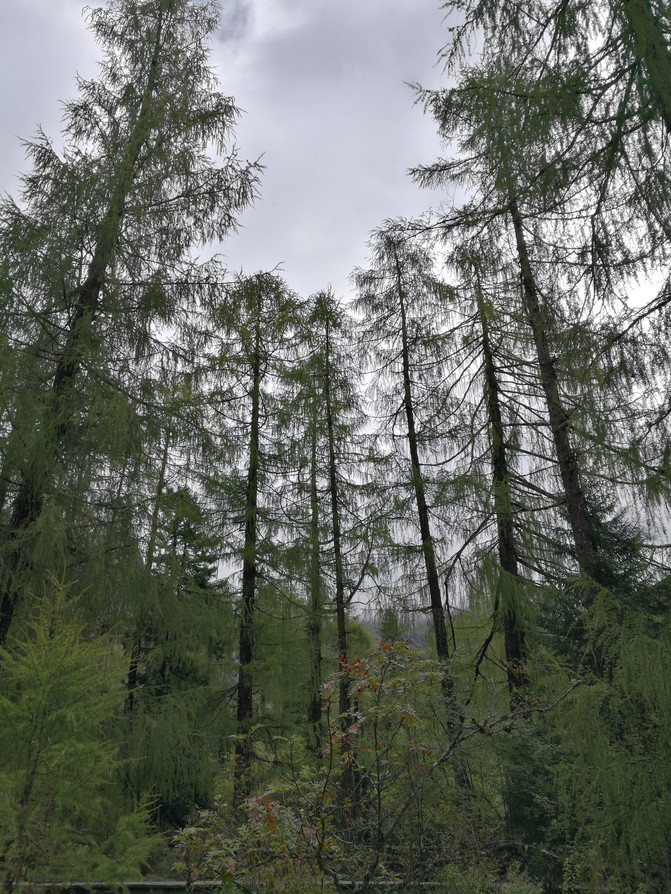
Shuangqiaogou-Sequoia forest
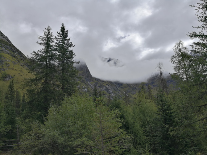
Shuangqiaogou-Sequoia forest
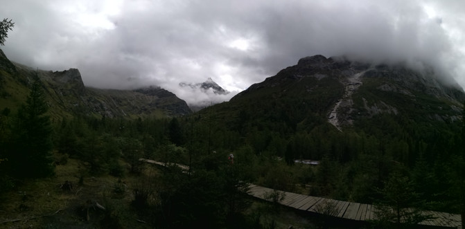
Shuangqiaogou-Sequoia forest
After exiting the Sequoia Forest, the sightseeing bus stops at the exit and takes the sightseeing bus to the next attraction-Potala Peak. It is surrounded by snowy mountains and is named because the Potala Peak is similar to the Potala Palace in Xizang. We have been waiting here for a long time, but the Potala Peak appears and appears from time to time in the clouds, and we never refuse to show the full picture. I originally wanted to walk the plank road from here, but after walking forward for a few hundred meters, I felt that the scenery on both sides had not changed much, so I returned to the bus stop and took a sightseeing bus to the next attraction-Nianyuba. This is a alpine lake. We walked along the plank road for a while. The scenery along the way kept changing. The meadow by the lake was full of unknown wild flowers, and yaks were leisurely eating grass.
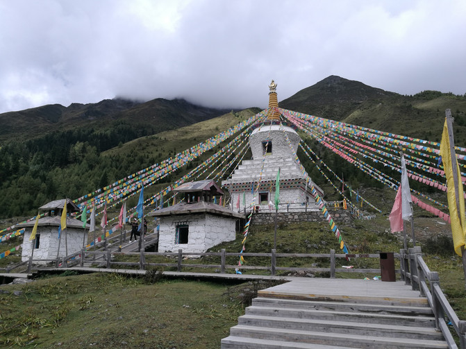
Shuangqiaogou-Baita
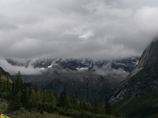
shuangqiaogou
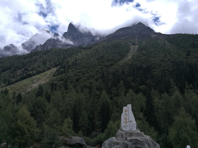
Shuangqiaogou--Potala Peak

shuangqiaogou

shuangqiaogou

Shuangqiaogou-Nianyuba
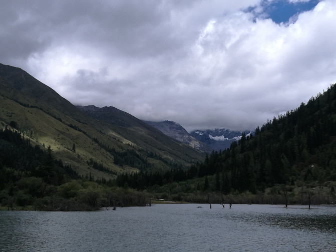
Shuangqiaogou-Nianyuba
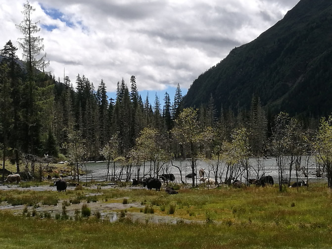
Shuangqiaogou-Nianyuba
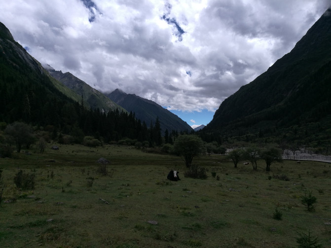
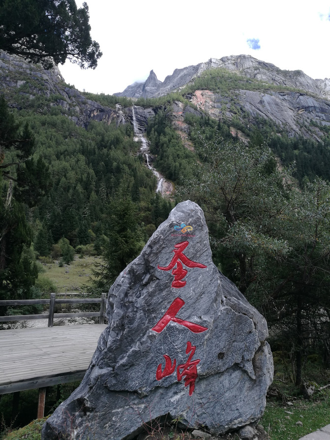
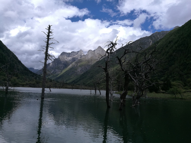
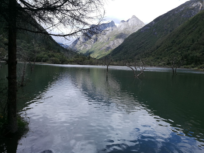
After walking for about an hour, the plank road in front was under maintenance and was no longer passable, so we had to return to the road. Continuing along the road, I saw Shengren Peak, a mountain peak that looks like a statue of Confucius. After walking on the road for about an hour, the scenery was not as beautiful as when walking on the plank road. When I saw a bus stop, I decided to take a bus to the next attraction-Longzhuco. Longzhucuo was formed by the sedimentation and blockage of alluvial sand from mountain torrents. There are many seabuckthorn trees in the lake that die but do not fall. They have the vitality of bearded old pine trees and the beauty of garden bonsai, without losing their straight and majestic. The uneven trees in the nearby lake and the snowy mountains in the distance form a beautiful picture.

shuangqiaogou
shuangqiaogou
Shuangqiaogou-Shengren Peak
Shuangqiaogou-Longzhucuo
Shuangqiaogou-Longzhucuo
After visiting Longzhuco, we took a sightseeing bus to the last attraction-Shenshenguoping. At this time, the sky cleared up. Under the sunshine, blue sky, white clouds and snowy mountains, clear streams, grass slopes, and cattle consumption formed a beautiful picture.
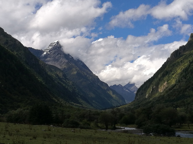
Shuangqiaogou--Shenshenguoping
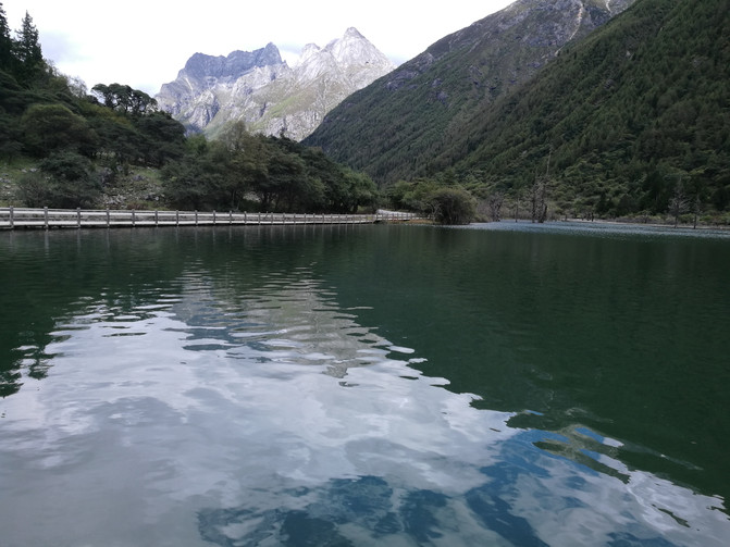
Shuangqiaogou--Shenshenguoping
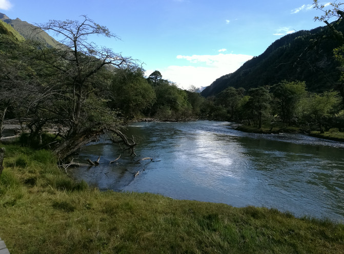
Shuangqiaogou--Shenshenguoping
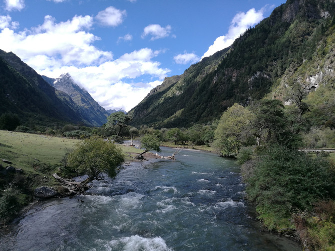
Shuangqiaogou--Shenshenguoping
It was already past 3 o'clock in the afternoon when I came out of Shuangqiaogou Scenic Area. I took a local off-road vehicle back to Changping Village and bought yak yogurt made by locals on the way back to the hotel. It had a strong milk aroma. There are many small shops serving local specialties on the small street outside the hotel. In the evening, I tasted the local specialty delicacy-yak meat hot pot on the small street, and ended the day with delicious food.
D9
The Changpinggou Scenic Area we are going to today is the most challenging attraction on this trip, because it requires a hiking trip on a plateau area with an altitude of more than 3000 meters.
Buy tickets at the Siguniang Mountain Visitor Center early in the morning, and then take a sightseeing bus to the entrance of Changpinggou Scenic Area.
There are ancient cypress trails, dry haizi and waterfalls dozens of meters high in Changpinggou Scenic Area. Siguniang Mountain is located 16 kilometers away in the ditch. When you enter the scenic area, you will see many horses. Not far away is the Lama Temple, a small temple that was once glorious in the history of Buddhism in the local area. Looking from the Lama Temple, you can see the looming Yaomei Peak in a corner where the clouds and fog are scattered. You can visit Changpinggou Scenic Area on foot or on horseback. We choose to visit the scenic area on foot.
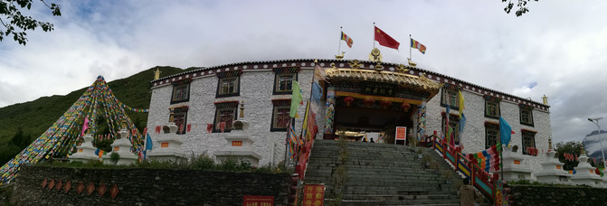
Changpinggou-Lama Temple
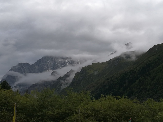
Changpinggou-Yaomei Peak in the Clouds
Entering Changping Gully, you will walk along the scenic area along the plank road. The green cypresses and green pines are lush on both sides, and the waterfalls and springs are rattling in the dense forest. You can see the ancient post road shuttling and extending through the vast forest. The first attraction I passed by was the Bug Foot Waterfall, which was named because the entire waterfall was divided into many small branches from top to bottom, much like the thin little feet of caterpillars. But to get close to the waterfall, we needed to climb a flight of stone steps. It took us about an hour to go back and forth, which was still very strenuous.

Changpinggou-Insect Foot Waterfall
After coming down from the Bug Foot Waterfall, we continued to walk along the plank road. Unconsciously, we walked several kilometers of the plank road and arrived at the end of the plank road-dead tree beach. There are many people gathered here, and it is said that one-third of the tourists return after arriving here. Further ahead is the horse trail. We did not stop and continued to move forward along the rugged horse trail. There are many sand and gravel on the road in front of you, and a large area of virgin forest is spread out in front of you. The ancient cypresses are tall and straight, the pine trees are dense and luxuriant, the fir trees and willows are dense to block the sky, and the sun shines through the canopy and sprinkles on the ground.
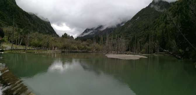
Changpinggou--Kushutan

changpinggou
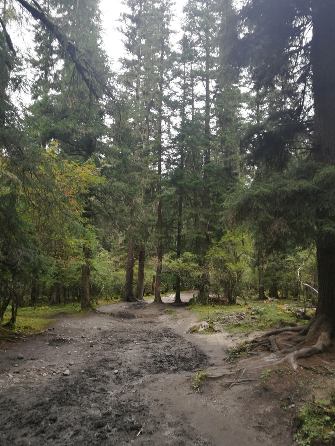
changpinggou
After passing through a dead tree forest like the Jurassic era, at noon, we arrived at the base camp, a wooden house built by local villagers. There is a small lake here, the water surface is calm, and the mountains and trees are reflected in the water. There is a static beauty, as if time is frozen here. The base camp can provide hot water. We had a simple lunch here, took a short rest, and continued to move towards the wooden mule.
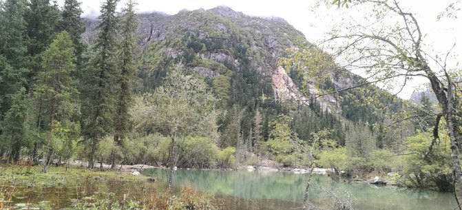
Changpinggou-base camp

Changpinggou-base camp
The road was relatively easy to walk at first, but before long, the road under our feet began to become muddy, some places were covered with gravel, and the trees on both sides of the rugged path were covered with moss, telling the unique tranquility and pristine. But the scenery along the road changes from time to time and is beautiful, sometimes quiet in the dense forest, and sometimes reflected in the shadows of trees in the lake.
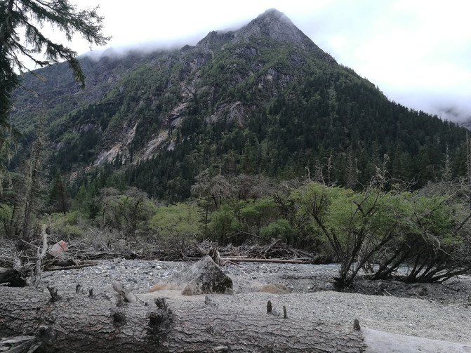
changpinggou
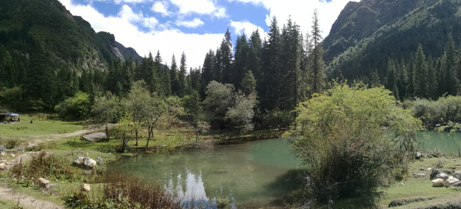
changpinggou
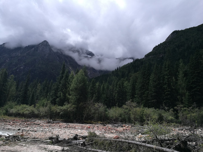
changpinggou
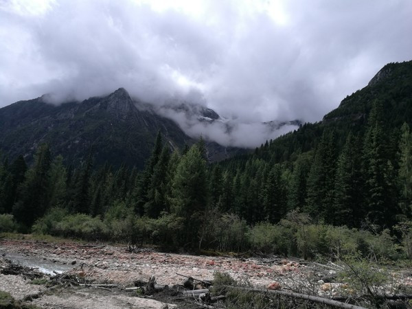
changpinggou
After walking through the vast forest of forests, we finally arrived at the wooden mule.
Mu Muzi is the end of Changping Gully. It is said that only one-third of the tourists who come to Changping Gully arrive here. Looking around, it suddenly becomes clear. The vast meadow mixed with primitive atmosphere is surrounded by mountains. The green grassland, white snow mountains, and cattle and sheep grazing leisurely constitute a tranquil and peaceful picture here, which actually makes us forget the fatigue of trekking.

Changpinggou-wooden mule

Changpinggou-wooden mule

Changping Gully-Mu Muzi
The sightseeing bus back to the Visitor Center in Changpinggou is at the latest at 5:30 p.m. In order to catch the sightseeing bus, we stopped here for a while and then reluctantly left. On the return journey, the clouds opened and the fog dispersed, and we saw the true appearance of Siguniang Mountain. The white snow peaks shone brightly under the sunshine.

changpinggou
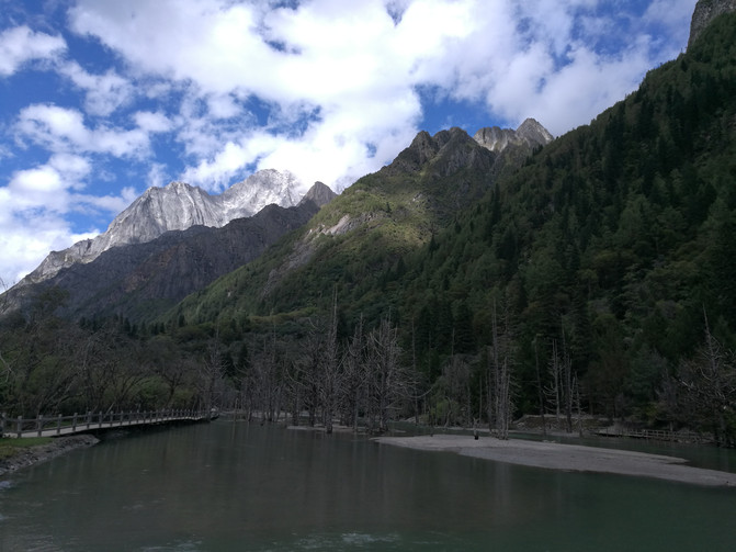
changpinggou
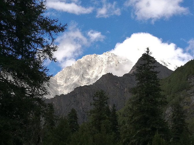
changpinggou

changpinggou
At 5:20, we returned to the gate of the scenic area. From around 8 o'clock in the morning and after more than 9 hours of hiking, we successfully completed today's challenge.
Before leaving in the morning, I had asked the hotel front desk to book a ticket back to Chengdu tomorrow. When I returned to the hotel, I confirmed with the waiter the bus back to Chengdu tomorrow morning, and I rested early.
D10
The bus back to Chengdu left Xiaojin County at 9 a.m.. In the morning, the hotel attendant drove us to the road to wait for the bus. At 10 o'clock, we got on the bus back to Chengdu. Cars traveled through the mountains all the way. When they approached Balang Mountain, they also saw spectacular clouds of clouds.
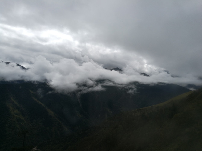
Balang Mountain Cloud Sea
At about 2 p.m., the car arrived at Chengdu's Chadianzi Passenger Terminal. Take Metro Line 2 to the booked hotel near People's Park to check in, rest for a while, and decide to go to Chengdu Internet celebrity Yulin Chuanxiang to eat skewers.
It's not too far from the hotel where we stayed. We went there early, but there were already many diners inside. The skewers here are self-service. After ordering the hot pot base, you can get the ingredients you want to eat. Finally, the waiter charges according to the amount signed.

Chengdu Cuisine-Yulin Chuanchuanxiang

Chengdu Cuisine-String Hot Pot
After a full meal, we came to the prestigious Jinli. Although it was night, the place was still crowded. Jinli is a famous pedestrian commercial street in Chengdu City, only a wall away from the famous Wuhou Temple. It is an antique building with the architectural style of the late Qing Dynasty and the early Republic of China, with the culture of the Three Kingdoms and traditional Sichuan folk culture as the main content. The layout of the ancient street is rigorous and orderly, with bar and entertainment areas, Sichuan famous restaurants and snacks areas, mansion inn areas, and special tourism and crafts exhibition areas. You can feel the local cultural atmosphere of Chengdu here.
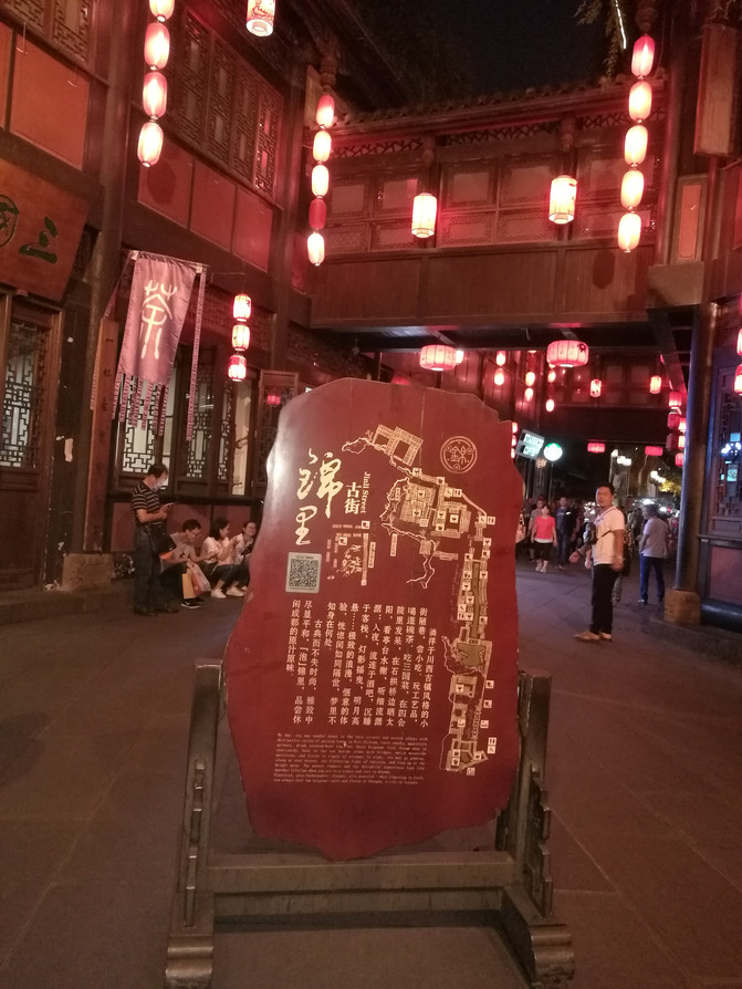
jinli

jinli
D11
Chengdu is a city with a very slow pace of life. We came to Chengdu this time to enjoy the slow life, so we did not arrange too many attractions in Chengdu. After breakfast in the morning, I decided to go to Du Fu's Cottage to have a look.
Du Fu Cottage was the former residence of Du Fu, the great realist poet of the Tang Dynasty in China, when he lived in Chengdu. In order to commemorate the poet Du Fu, later generations continued to repair and expand his former residence, forming a famous cultural shrine with simple and elegant architecture and beautiful gardens.

Du Fu caotang

Du Fu caotang
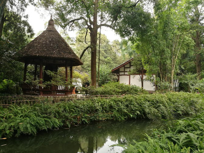
Du Fu caotang
When visiting Chengdu, you must check in Kuanzhai Alley. After visiting Du Fu Cottage, it was nearly noon, so we took a bus to Kuanzhai Alley.
After putting down the Jungar Rebellion in the fifty-seventh year of Kangxi, the Qing government selected more than a thousand soldiers to garrison Chengdu and build Shaocheng. Today's wide and narrow alleys are the legacy of Shaocheng. The wide and narrow alleys are composed of wide alleys, narrow alleys, and well alleys arranged in parallel. They are all antique courtyards made of indigo bricks and tiles. This is also a relatively large-scale ancient street of the Qing Dynasty left over from Chengdu, recording the vicissitudes of old Chengdu. Its architectural style combines the characteristics of western Sichuan folk houses and northern courtyard houses. Now it has formed a complex cultural and commercial street focusing on tourism and leisure, with distinctive regional characteristics and a strong Bashu cultural atmosphere.

kuanzhai alley
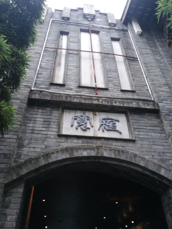
kuanzhai alley
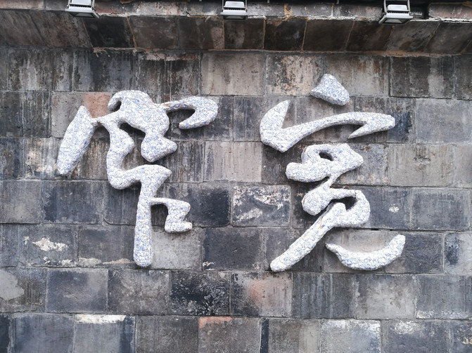
kuanzhai alley

kuanzhai alley
After visiting the wide and narrow alleys, we walked to the nearby People's Park. Chengdu City People's Park, formerly known as Shaocheng Park, was built in 1911 and is a good place for leisure and entertainment in Chengdu. Heming Tea House in the park is a time-honored brand that is a place for family gatherings, friends dinners, and leisure breaks. Although it is past 3 o'clock since we arrived here, it is still difficult to find seats. It seems that the people of Chengdu live a leisurely life. After finally finding seats, we also sat down and asked for a cup of green tea to enjoy the leisure and comfort like the people of Chengdu.
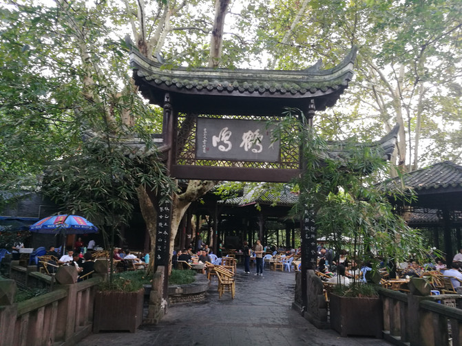
Heming Tea House
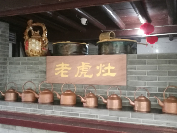
Heming Tea House
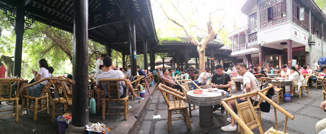
Heming Tea House
After coming out of People's Park, we wandered around the street and bought local bacon and other local specialties at a market not far from the hotel. I bought sugar-oil fruits from a small stall on the roadside. They were much more delicious than the ones we ate in a scenic spot last time. Sure enough, the delicacy had to be found in the market.
D12
I arrived in Chongqing last year just in time for the National Day holiday. There were many people at Ciqikou and I couldn't have a good look. I wanted to visit Ciqikou again this year. Take the train from Chengdu to Chongqing in the morning and choose to get off at Shapingba, not far from Ciqikou.
As soon as I got off the car, a heat wave hit my face. It seemed that Chongqing was really a "stove". After storing our luggage, we took the subway to Ciqikou. But when I arrived at Ciqikou, I saw that there were still many people, and it was just in time to build roads in the Ciqikou area. Coupled with the hot weather, I suddenly lost my mood and hurried around before leaving.
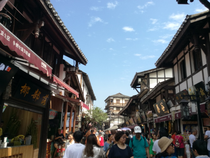
ciqikou
Back at the train station to pick up our luggage, we took a bus to Wansheng County, where the Black Valley Scenic Area is located.
Arriving in Wansheng County, I finally found the hotel I booked in a dilapidated building. This was the worst hotel we stayed in on this trip. Fortunately, there was a delicious noodle shop in the market behind the hotel. We settled in this noodle shop for several subsequent breakfasts and dinners.
D13
There is a direct bus from Wansheng Bus Station to the Black Valley Scenic Area in the morning.
Chongqing Black Valley Scenic Area has high mountains and dense forests and is inaccessible to people. It retains one of the few natural ecosystems in the subtropical and temperate zones of the same latitude on the earth. The forest coverage rate reaches 97%. It is currently the largest in Chongqing and the most well-protected original ecology. The natural ecological scenic area is praised by experts as the "Chongqing-Guizhou Biological Gene Bank", Chongqing City unique "Biological Gene Bank", and "Southwest Shennongjia". The characteristics of the scenic spot can be summarized as secluded, dangerous, strange and beautiful.
The Black Valley Scenic Area is a long canyon. You can start visiting from the south gate on the mountain or the north gate at the foot of the mountain. There are sightseeing buses from the visitor center to the south gate and north gate respectively. We chose to enter from the south gate of the mountain and visit down, which could save physical strength. Entering the scenic area, there is a 1-kilometer sightseeing cableway or you can also walk. There were very few people, so we chose to walk down the mountain. Walking down the stone steps, you can see dense bamboo forests, accompanied by the sound of gurgling water, breathing the humid air, and from time to time dragonflies and butterflies walk with us.

black Valley

black Valley
The first thing we came to was Shenlong Waterfall, where water poured down from the top of the mountain, stirring up layers of water. There is a naturally formed boulder in the Shenlong Cave next to it, resembling a dragon head, giving the Shenlong Cave its name. Then I came to a waterfall. The water flow here is very large. You can walk to the waterfall and get in close contact with the waterfall. It is said that the content of negative oxygen ions here is extremely high. Further down, accompanied by waterfalls and streams, passing through scenic spots such as Ciba House and Double Dragon Pearl Playing, we arrive at Fengxiang Bridge. There are lush trees here, water flows down in moss covered stone cracks, and stalactites hang from the stone walls.

Black Valley-Shenlong Waterfall

Black Valley-Shenlong Cave
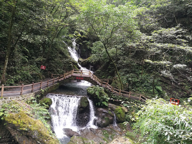
black Valley

black Valley
Go down to the narrow and deep valley bottom, where cliffs on both sides face each other, and the stream in the middle is clear. The plank road and pontoon bridge are erected on the stream and extend meandering across the water, which is quite strange. When people walk on it, rain and fog come to their faces from time to time, as if they are wandering in the Dragon Palace. Passing through scenic spots such as Monkey King Cave and Eagle Claw Rock, there are three parallel peaks in front of us that look like a camel. Because the camel has a head and a tail and a tail to the east, it is named "Camel Westbound".
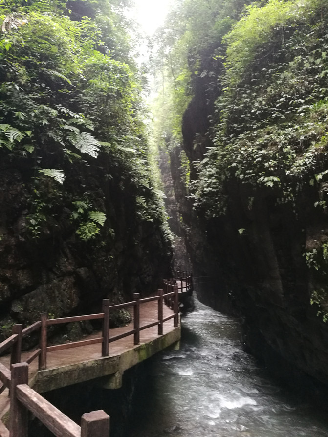
black Valley
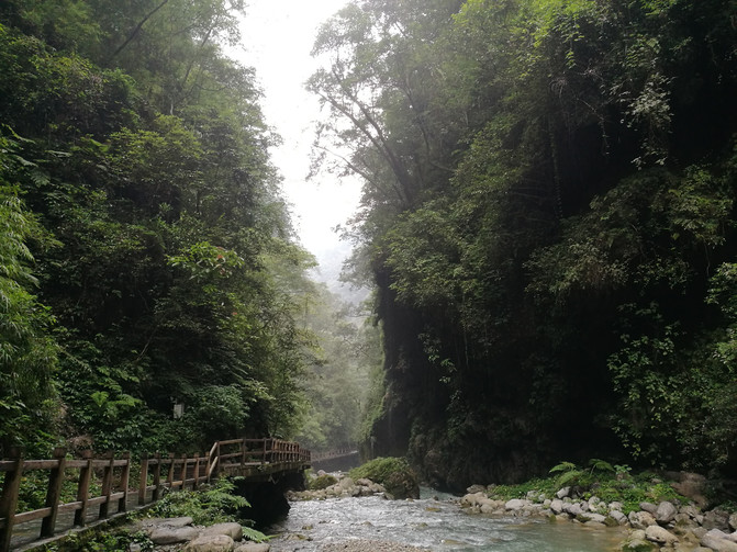
black Valley
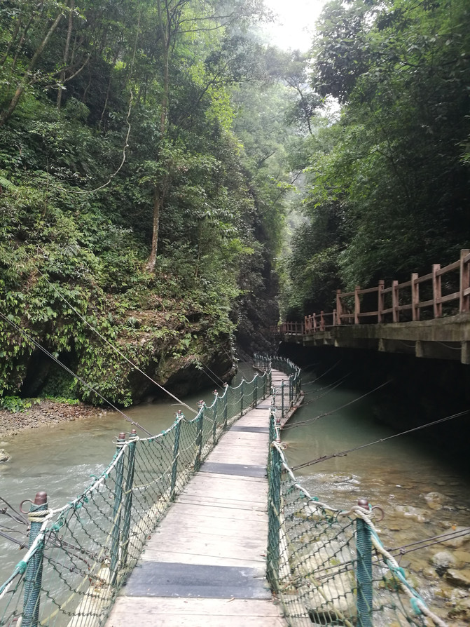
black Valley
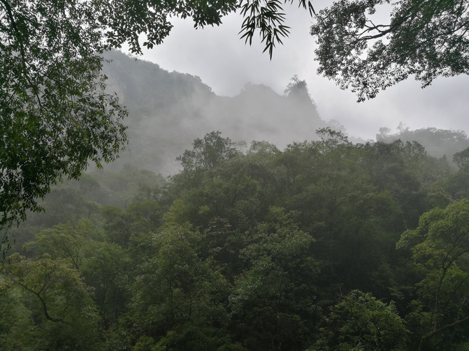
Black Valley-Camel heading west
Coming out from the north gate, the mountain road is very foggy and the visibility is very low. We took the sightseeing bus, and the driver took us to the bus station heading for Wansheng County. We took the bus back to Wansheng County.
D14
Today we are going to Jinfo Mountain, another destination of our trip to Chongqing. Take a bus at Wansheng County Bus Station in the morning and arrive in Nanchuan County in 2 hours. From Nanchuan County, you have to transfer to a bus to Jinfo Mountain Scenic Area. You can reach Jinfo Mountain Scenic Area in more than an hour. We were going to stay on the mountain today, but we didn't want to bring too much luggage up the mountain, so we first went to Tianxing Town at the foot of the mountain, left our luggage at the booked Liangjiang Hotel, and then went up the mountain simply.
Jinfo Mountain, known as Jiudi Mountain in ancient times, belongs to a typical karst geological landform. It is included in the World Natural Heritage list due to its biodiversity characteristics and unique karst landform characteristics. With its unique natural features, a wide variety of rare animals and plants, majestic and strange rock shapes, mysterious and deep caves and palaces, unpredictable meteorological landscapes and relics of famous temples and ancient temples, it is one of the four famous mountains of Bashu.
By car from Tianxing Town, you can reach the Visitor Center of Jinfo Mountain Scenic Area in a few minutes. The ticket we booked is a set ticket that includes a sightseeing bus and a cableway. You can enter directly by swiping your ID card. Because the main attractions of Jinfo Mountain are concentrated on the mountain, you need to take a sightseeing bus from the tourist center to the cableway station, and then take the cableway up the mountain.
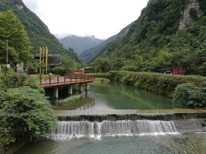
jinfoshan
It was noon, and not many people took the cableway up the mountain. Sitting in the carriage, I can see tourists descending the mountain in the opposite carriage from time to time. I still think they have gone down the mountain so early. As the altitude rises, the fog becomes heavier and heavier. When we reach the cableway station, it has already begun to rain. It is white in front of us and the visibility is very low. No wonder those people went down the mountain early. I wanted to play all the way first and then go to the farmhouse near Yaochiba. But in such weather, I had to go to my place first. Call the innkeeper. He is nearby and can come and pick us up. Get in the boss's car and walk on the road. There are dense bamboo forests on both sides. In a short while, you will arrive at your residence in Yaochiba. After checking in, the boss suggested that we go to Gufo Cave not far away first.
After coming out of the inn, we followed the directions instructed by the boss and arrived at the entrance of Gufo Cave in a few minutes. Follow the narrow stone steps and enter the cave. At the bottom of the cave is a huge cave hall. There is a naturally formed stone Buddha in the middle of a pool of clear water; on the other side of the cave hall is a statue of Guanyin in the middle, and along the stone wall there are many arhat statues. Follow the statue of Arhat and go up the channel to reach another hole. Here is a viewing platform with cliffs below the viewing platform. Near the entrance of the cave, there are low grass and small yellow flowers in bloom. The entrance of the cave is filled with fog, making people feel like they are in a fairyland. Walking out of the cave entrance, you can see the spectacular sea of clouds on the viewing platform mountain.

Jinfo Mountain-Ancient Buddha Cave
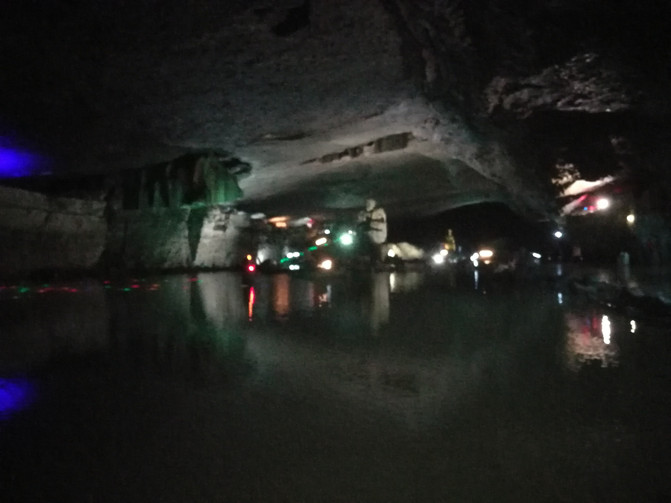
Jinfo Mountain-Ancient Buddha Cave
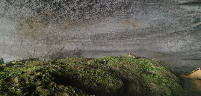
Jinfo Mountain-Ancient Buddha Cave
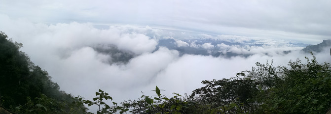
Jinfo Mountain--Ancient Buddha Cave Cloud Sea
It was not until the old man guarding the Ancient Buddha Cave came to call us and said that it was closing that we reluctantly came out of the cave. Down the mountain road, not far away, what comes into view is a large green meadow, with a few lambs leisurely eating grass. Follow the plank road to the depths of the meadow, there is a small lake. The surrounding green mountains, green grass, sky and clouds are reflected in the water, forming a beautiful picture. The deeper you go, the scenery changes. The color of the grass on the hillside begins to turn yellow, low shrubs appear, and occasionally large white wild chrysanthemums appear.

Jinfo Mountain-Yaochiba

Jinfo Mountain-Yaochiba
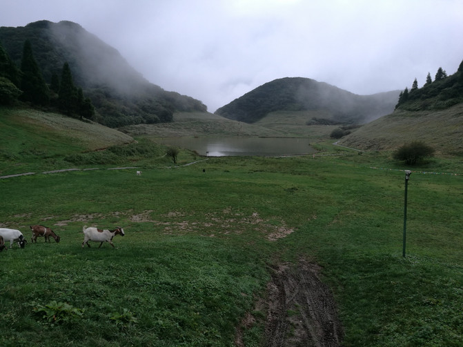
Jinfo Mountain-Yaochiba
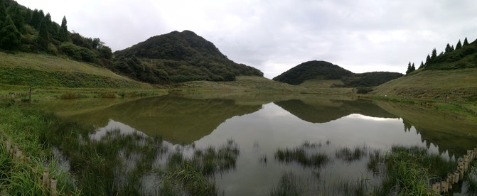
Jinfo Mountain-Yaochiba

Jinfo Mountain-Yaochiba
Unconsciously, the sky got dark, and it was also the meal time agreed with the innkeeper. We returned to the inn along the way we came.
D15
It started to rain in the morning and the temperature was very low. After breakfast, we bid farewell to the innkeeper and walked down the mountain. Walking along the road and passing through Yaochiba, you can appreciate this beautiful meadow again from another angle.
Walk for more than 20 minutes to the entrance of the Ecological Stone Forest Scenic Area. Walking through the stone forest along the stone steps, there are dense bamboo forests and trees everywhere, with stone pillars and stalagmites of various shapes scattered among them. Because there are not many tourists here, the ecological environment is well preserved, and the stone forest full of green rocks exudes wild charm.

Jinfo Mountain-Ecological Stone Forest

Jinfo Mountain-Ecological Stone Forest

Jinfo Mountain-Ecological Stone Forest

Jinfo Mountain-Ecological Stone Forest
From the ecological stone forest, you will reach the cliff plank road. The plank road has a total length of 3.5 kilometers and is built almost on a cliff with a vertical angle of 90 degrees. It is 40-50 meters above the ground. When walking, it is like walking in the sky. Walking on the plank road, we have a wide view. We once again see the magnificent sea of clouds. The mountains in the distance are like small islands floating in the sea of clouds. Since we came down from the mountain early in the morning and didn't meet anyone along the way, we could enjoy the beautiful scenery here.

Jinfo Mountain Cloud Sea

Jinfo Mountain Cloud Sea

Jinfo Mountain-Cliff Plank Road
But before walking far, I saw the clouds and mist beginning to rise rapidly. In an instant, the clouds and mist spread across the plank road and climbed to the top of the mountain. The plank road was wrapped in thick fog. By the time we arrived at Yanzi Cave, the visibility was already very low. At this time, tourists began to come up from the foot of the mountain. I guess that only thick fog can be seen going up the mountain at this time.
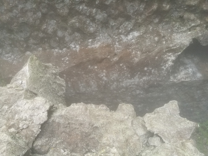
Jinfo Mountain-Yanzi Cave

Jinfo Mountain-a cliff plank road in dense fog
Continue to walk through the clouds on the plank road and pass the Golden Turtle Chaoyang Scenic Spot. Due to the heavy fog, I saw nothing. After crossing the Jianzhu Sea, I wanted to go to the Golden Buddha Cave, but the staff of the scenic area said that the Golden Buddha Cave was under maintenance and was not open to the public, so I had to go to the Golden Buddha Temple.
Follow the road up in Qiunianping service area and walk to the Golden Buddha Temple for more than 10 minutes. The Golden Buddha Temple is big, but it looks very new, like a newly built temple. There was nothing to see inside, so he came out after turning around. Returning along the road, I had lunch at a canteen at the entrance of Dujuan Wangting Scenic Area on the way. When we came, it was not the season when the azaleas were in bloom, so we didn't enter the azalea royal palace scenic area. We went straight back to the cableway station and took the cableway down the mountain. On the way back by the sightseeing bus, we passed the Bitan Yougu Scenic Area, a Xikou canyon-type eco-tourism scenic spot. We didn't get off the bus and went straight back to the tourist center.
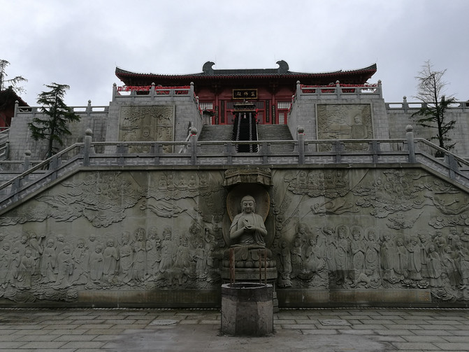
Jinfo Mountain--Jinfo Temple
We took a bus from the visitor center back to Tianxing Town. After checking in at the hotel, we went to Tianxing Hot Spring City in the town. The overall architectural style of Jinfo Mountain Tianxing Hot Spring City combines Chinese style and modernity. There are many soaking pools of different sizes and functions. It is one of the core products of Jinfo Mountain leisure and vacation, but I personally feel average.
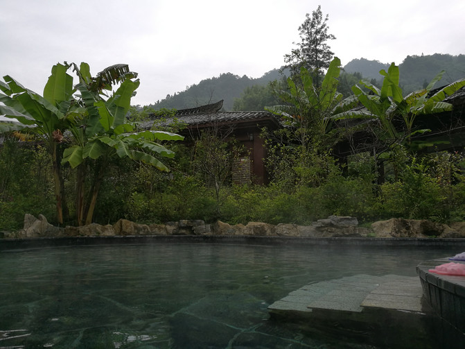
Tianxing Town-Tianxing Hot Spring City
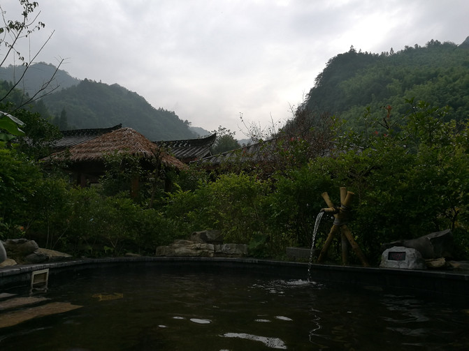
Tianxing Town-Tianxing Hot Spring City
After coming out of the Hot Spring City, we strolled around the town, tasted the local specialty Fang bamboo shoots, and then returned to the hotel to rest.
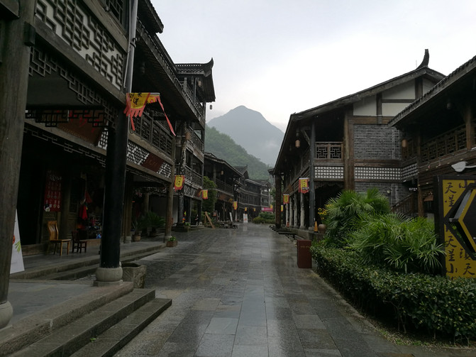
tianxing town

tianxing town
D16
Today is the last day of our trip. After breakfast, we took a bus back to Nanchuan County. The plane took off from Chongqing Airport at 7:15 p.m... I wanted to visit Hongyadong after Chongqing. However, due to the delay in waiting for the bus in Tianxing Town in the morning, I only bought a ticket from Nanchuan to Chongqing Airport at 2:00 p.m. The result became a half-day tour of Nanchuan County.
After wandering around Nanchuan County for half a day, I sold some glutinous rice cakes and dried rice noodles in the local market. Arriving at Chongqing Airport at 5:00 p.m., the car drove directly to the entrance of Terminal T3. The plane took off on time at 7:15 and landed smoothly in Tianjin at 21:45.
November 2018
