2020 Autumn Tour (4): Colorful niche secret areas (new trajectory map)
What strikes my mind during this trip is the colorful colors: the ochre Aiken Spring, the green Toca Lake, the vast Eye of Gene, and the white white water platform. All the colors are accompanied by the golden brilliance of autumn, just like a kaleidoscope. Magic.
day 40 Ruoqiang to Mangya
Take National Highway 315, cross the Altun Mountains and leave Xinjiang, and reach Mangya, Qinghai. The journey is 412 kilometers.
In 2019, when taking National Highway 315 to Wusut, Yadan on the water turned to Dunhuang. This time, we can make up for this shortcoming.
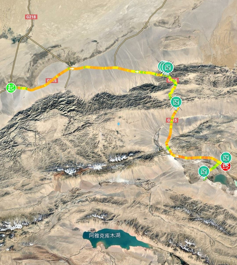
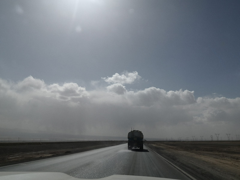
Walking in the Gobi Desert, the altitude rises all the way

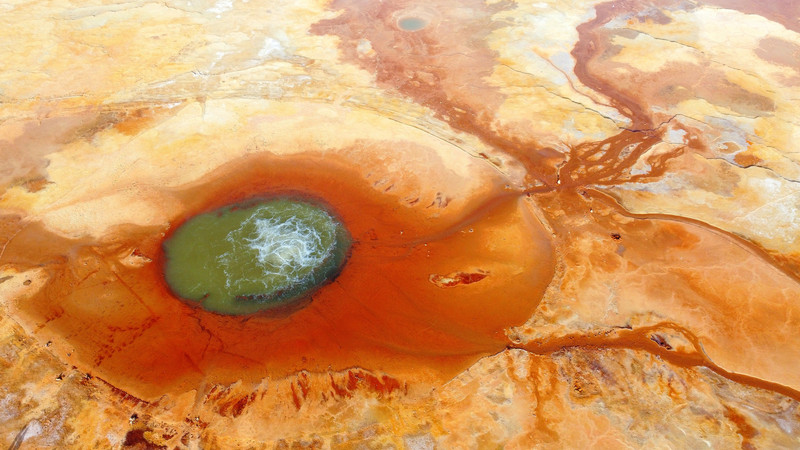
Aiken Spring: Not far from National Highway 315, there are dirt roads. The overall situation is relatively straight. It takes more than an hour to reach Aiken Spring. Aiken Spring has a diameter of more than 10 meters. Looking at the sign, it is still a ringing spring. The louder the voice, the bigger the spring water. The spring hole is like boiling water, constantly rolling and rising. Sulfur minerals around the spring hole have been precipitated for a long time and are colorful. Looking down from the sky, the spring eye, the gushing spring water and the deep red ring-like sediments in the surrounding land form a peculiar pupil shape, like a pair of glasses inlaid on the earth, so everyone calls it the "Eye of the Earth","Eye of the Devil".


day 41 Mangya to Golmud
Take the S303 Provincial Highway to cross the Qaidam Basin and reach Golmud City. The journey is 468 kilometers

Mangya Jade Lake is larger in scale than Dachaidan Jade Lake. Driving around counterclockwise, all kinds of greenery come into your eyes. The salt ponds are of different depths and different shapes. They are pure and transparent, like jade inlaid in the Gobi Desert., is a veritable emerald lake.

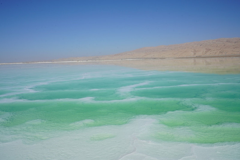
Salt Lake is still being mined

salt bridge
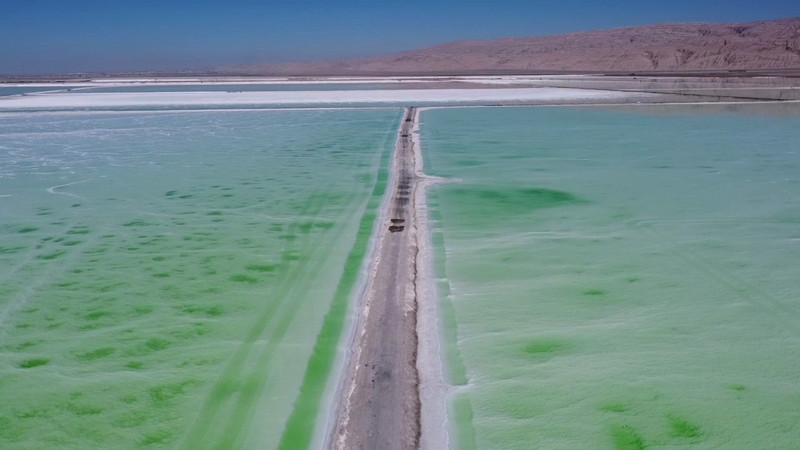
Crystalline salt is like lace

Green marshmallow

The famous T-walk

Enter Golmud City and serve mutton


day 42 Golmud
Strolling around the city

city logo

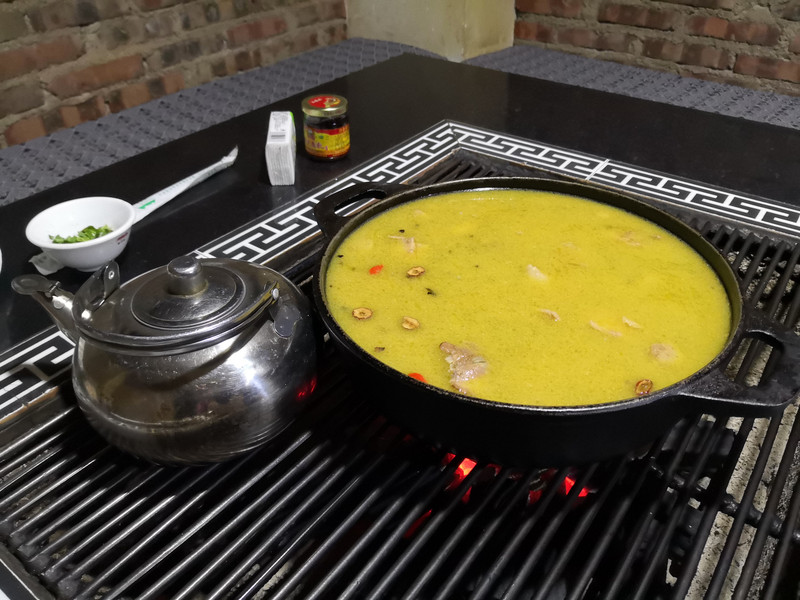
Mutton tripe soup

day 43 Golmud to Maqin
Returning to the plateau, covering the winter to Cuona Lake, a journey of 598 kilometers

After turning from Xiangriman to Dema Expressway, I saw a large area of lake water in front of me and the iconic red grass beach, which was Donggeicona Lake. There were almost no tourists on the entire lake, and the lake was quiet. The red water grass by the lake is a short and inconspicuous kind of grass. It is so red that it looks like an embroidered carpet has been spread on the ground.
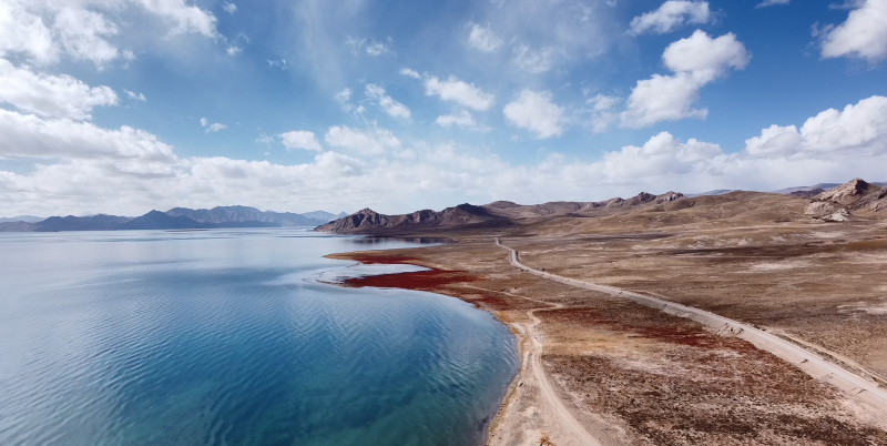


Winter Geicona Lake is very close to Huashi Gorge. The stones on the top of the mountain are completely different from those at the foot of the mountain. They look like petals and feel very consistent with the place name.

Driving yaks
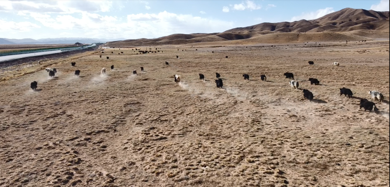

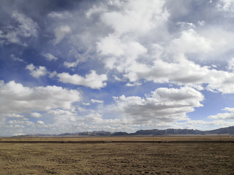
Scenery along the road

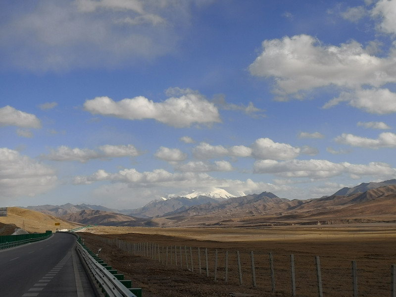


day 44 Maqin to Seda
Leaving Qinghai Province, take National Highway 548 into Sichuan Province, the journey is 482 kilometers.

Ma Qin's patron saint

Due to the long-term treatment of Nian Baoyu, it was closed, and the plan was changed to leave Qinghai via Dari to Banma.


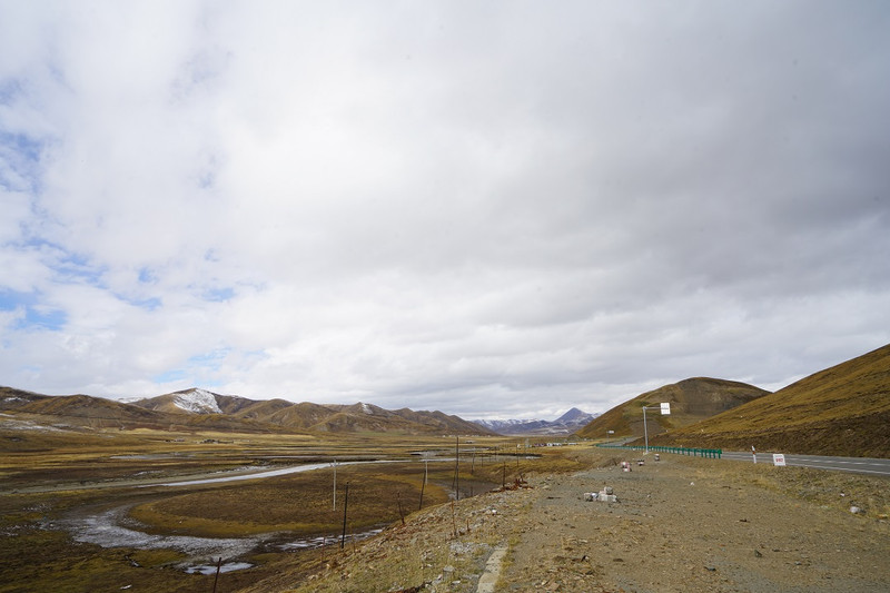
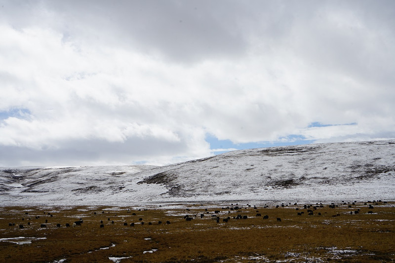


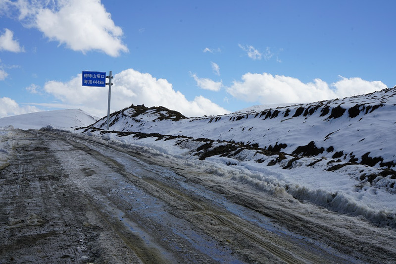
Along the way, I crossed several passes with an altitude of more than 4,000. The mountains were covered with snow and the trees at the foot were green

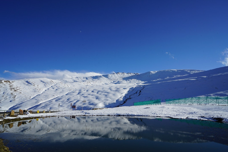
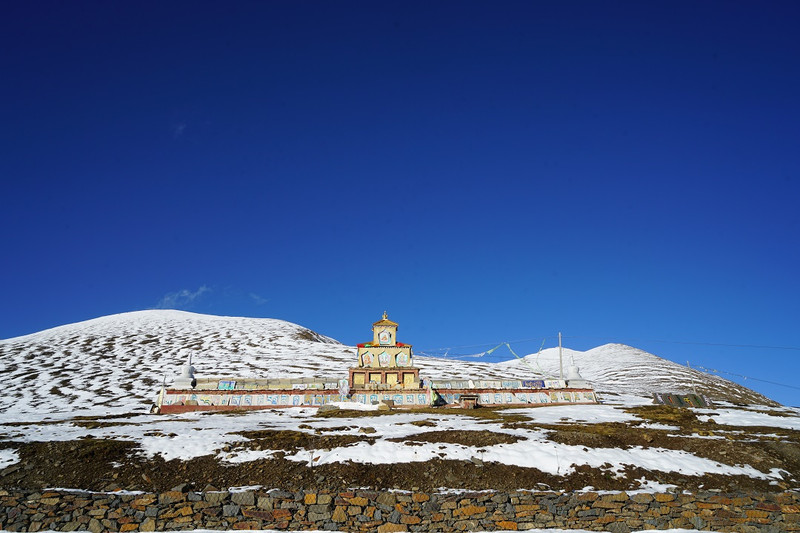
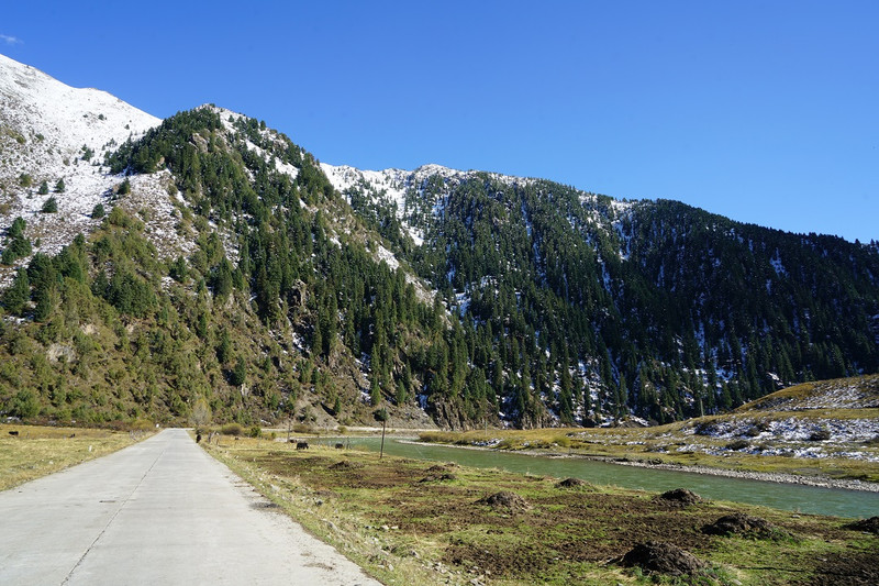


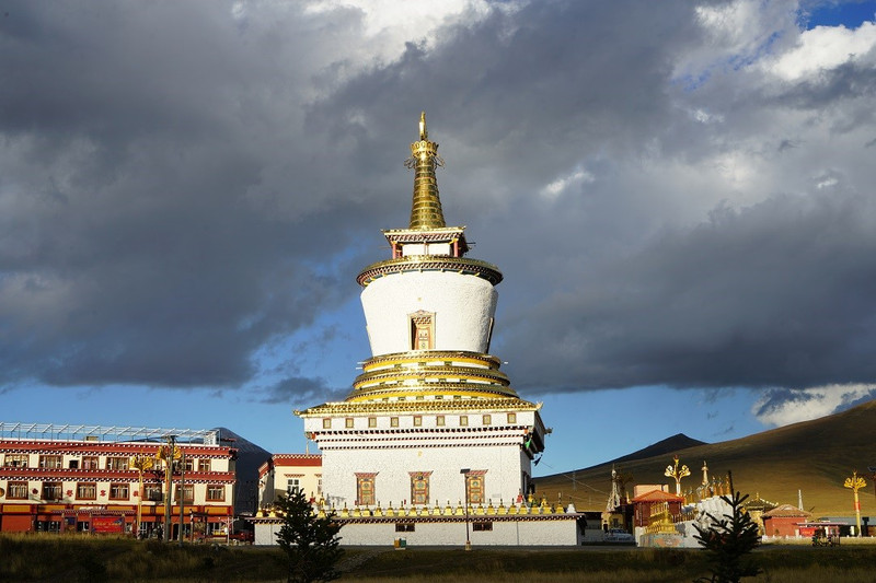
It's almost 6 p.m. in Seda, Sichuan. The pagoda under the sunset
dinner
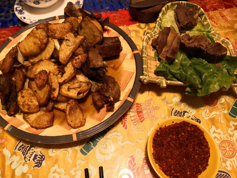
day 45 Seda to Xinlong
No trajectory was recorded today. Seda took County Road 6983 (passing through Nailongshan Snow Mountain), National Highway 317 and National Highway 227 (Yalong River Grand Canyon Section) to Xinlong County, about 240 kilometers.
In the square of Seda, a huge prayer wheel stands

Seda is not only the Buddhist College, but also Dongga Temple. Dongga Temple was built in the early 16th century and has a history of more than 500 years. It is a branch of Tashilhunpo Temple of the Yellow Religion and is located on the Jinmen Grassland.
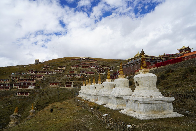


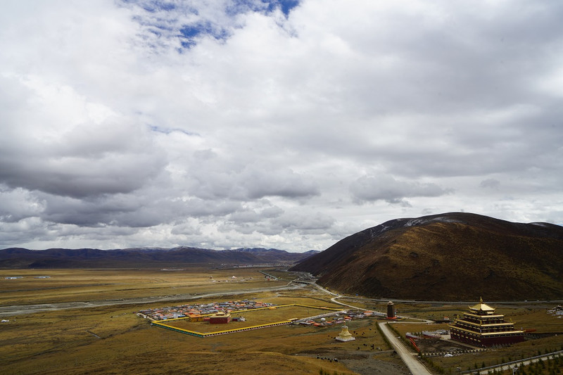

Along the way, at the highest point of the road on the top of the mountain, there is a sign marking Nailongshan Pass, with an altitude of 4580 meters. After this point, the mountain road begins to go down.
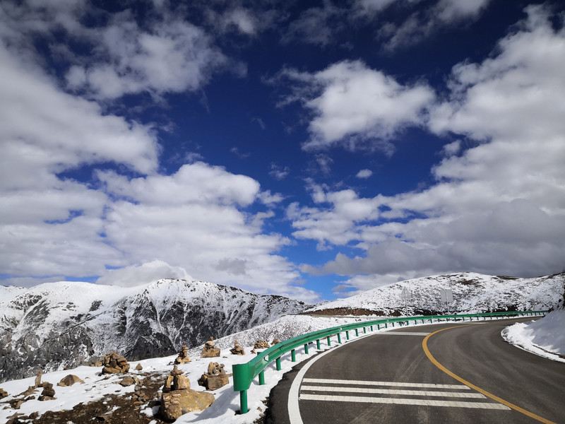


The row of snowy mountains ahead should be the Shaluli Mountains.


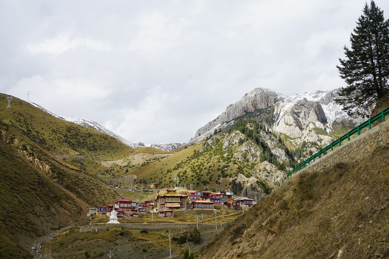
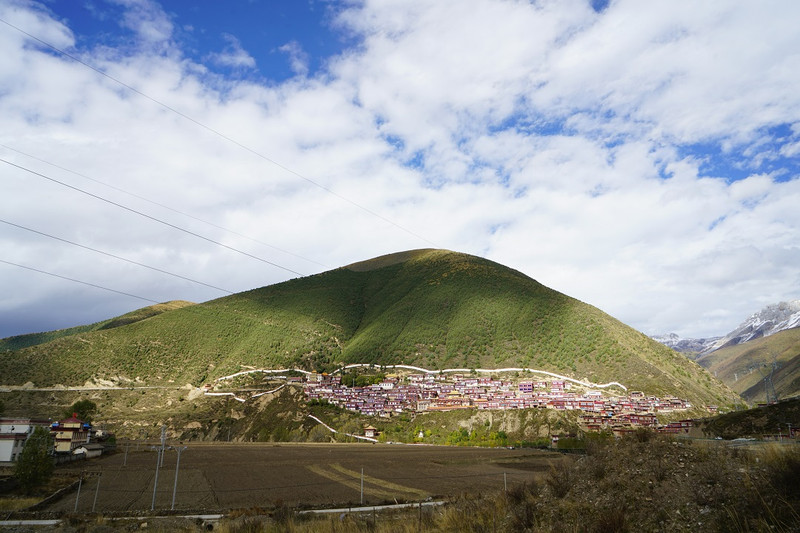
As we approached the foot of the mountain, we vaguely saw that there seemed to be caves and buildings on the hill ahead. Looking closer with the lens, it is true that such mysterious buildings are very common in Tibetan areas. This small temple at the foot of the mountain is surrounded by mountains and rivers, with beautiful scenery.


Towards Xinlong Litang

At the foot of the mountain, there is a red hiding house
Long Mani Wall


This is the Xinlongbori Bridge. It was built in the Qing Dynasty. The piers look like two solid bunkers from a distance, all made of round fir, pebbles and rubble. In the middle of the two piers, 4-6 round logs are used to support an arch. The length of the round logs gradually increases from bottom to top to form two cantilever arms. Then beams are erected on the cantilever arms, bridge plates are laid, and then installed. Rails form the bridge body. The "umbrella"-shaped structure with stone sheets stacked on the bridge pier is the bridge pavilion. The most amazing thing is that the entire bridge does not use a nail or a piece of iron. Every joint is connected with a wooden wedge, which is primitive and practical.

day 46 Xinlong to Litang
All the way to the plateau Tibetan-style scenery, plus the small area of Cuoka Lake, and then to the sky city-Litang, a journey of 181 kilometers

The Xinlong houses are obviously different from the Tibetan houses we saw before. The ground floor is a traditional rammed earth wall, and the whole building is large and small at the bottom, majestic and rugged. What is unique is that they embellished 1-3 "Bengke" on the second and third floors (in Tibetan,"Bengke" means a frame of wood,"Ke" means a house, and "Bengke" means a house of wood.) Auspicious patterns are carefully carved on the lintel and window frames and colored in different colors.
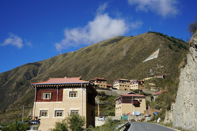

More than ten kilometers of steep mountain road
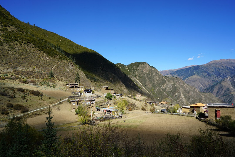

Coka Lake: Spiral up along the mountain depression, a green lake appears in front of you, surrounded by temples with gold roofs and red walls. That is Coka Lake. The lake is not very big. The jasper-like lake water is crystal clear, and it is a pure natural mirror of the sky.
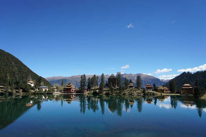


Coka Temple by the lake has exquisite architecture


There are no boats on the lake. It is very quiet and clean. A kaleidoscope collects the figures of blue sky, white clouds, green trees, green mountains, and red temples.


The altitude from Xinlong to Litang has been increasing, and the vegetation has changed significantly.

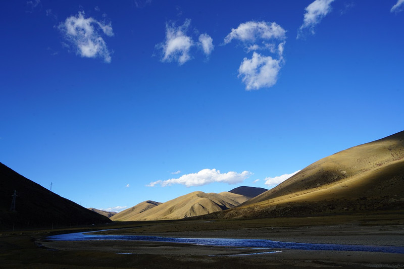

It is already 5 pm when we arrived at Litang due to road construction. Sky City. This is the third time we have been here. The facilities in the county are getting better every time. Holiday Inn Express has already opened this time.

Get settled, look at the blue sky, and go to Litang Chang Youth Kerr Temple. The resplendent temple is surrounded by gorgeous murals shining with golden brilliance under the sunset.
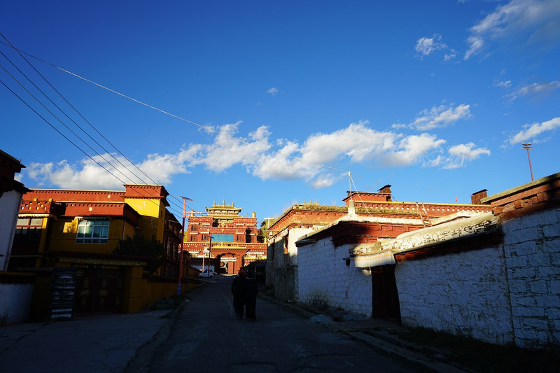
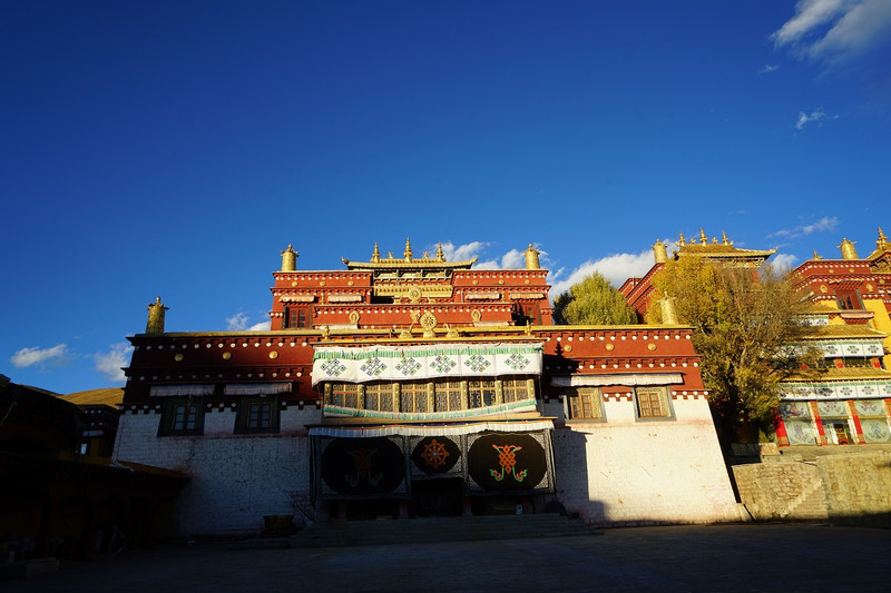


The local Tibetans happily communicated with us and hooked their shoulders to take photos. Happiness came smoothly

day 47 Litang
Litang Ge Nie South Line: Ge Nie Mountain Ge Nie Eye, journey 188 kilometers
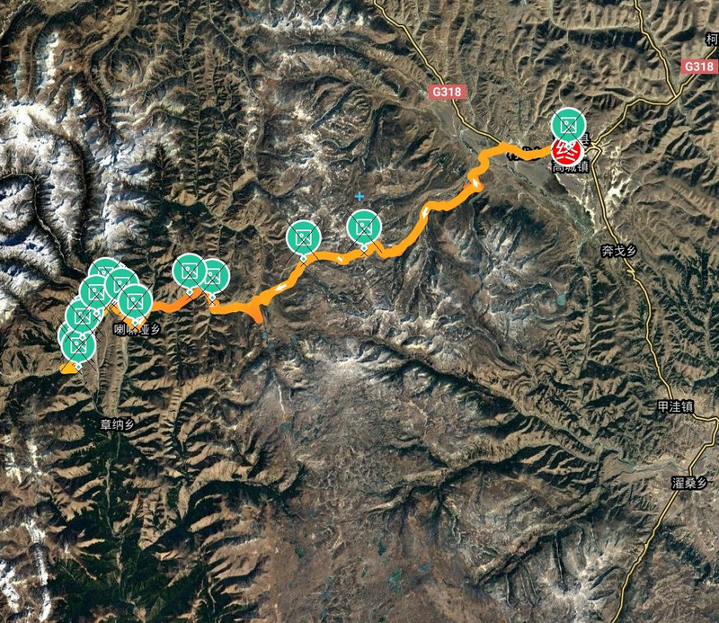
When I went to the Eye of Genie, the navigation could not be displayed. On the way, I encountered multiple intersections without road signs. There were no passers-by to ask, so I stopped to ask for directions.
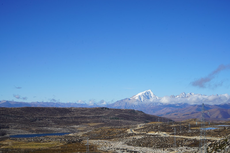
Gravel all over the mountains and plains

I first passed by Baita Park, but the gate was closed. When I returned in the afternoon, I passed by again and saw a note on the door that read "Open the door and pull the line". It turned out that you could enter, but you had to close the door behind you. There are 119 small towers in Baita Park surrounding the main tower, forming a unique Tallinn. These 119 small towers represent 119 villages in the county. The main tower is 33 meters high and the small tower is 2.5 meters high. There is also a large prayer wheel, which is majestic against the blue sky.


Gene in autumn, with pure skies, golden grass, green water, and colorful forests on slopes, is a large-scale scenic spot.

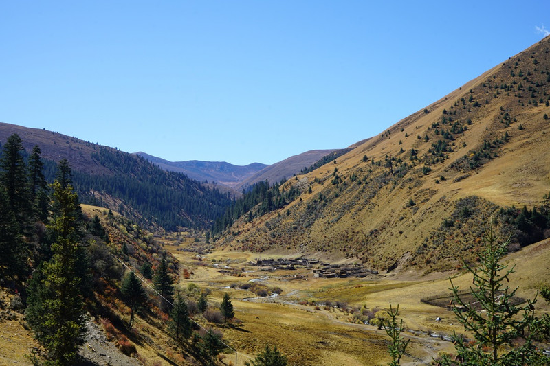

Yaks also have unique style

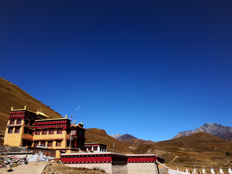
Foot Temple and White Pagoda


The Eye of Genie has to use a drone to capture a panoramic view. Looking down from the sky is like an eye


The small pond next to it has an effect that is no less than Gnie's Eye

After taking the eye of Ge Nie, go down the dirt road to the village. The river comes from the snowy mountains in the distance
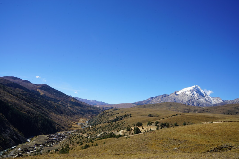


backhaul

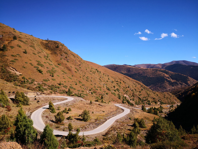
Hot springs, Tibetans soak their feet
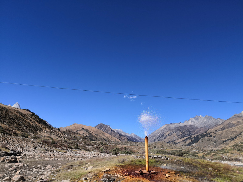

Litang West Gate

day 48 Litang to Xiangcheng
To the rural city, bypass the popular Daocheng Aden, and have a scenic journey of 285 kilometers

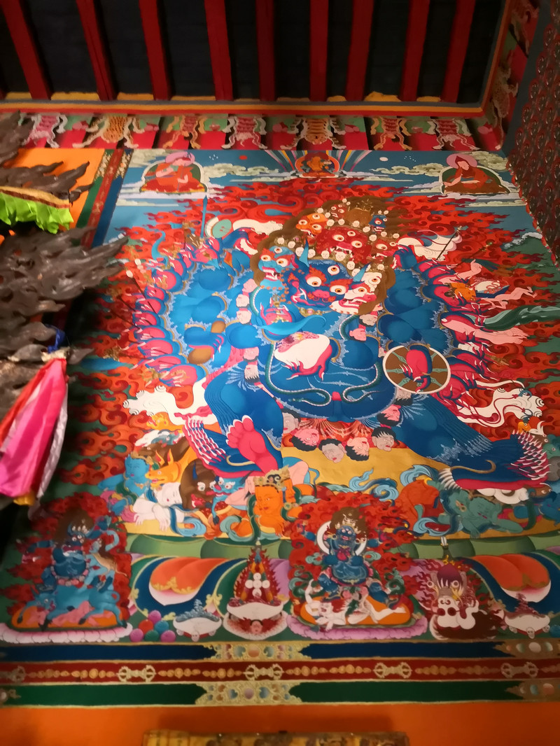
Rila Temple has red, blue and white exterior walls and belongs to the Sakya sect. The monastery lama led us to visit. He has been studying here for 3 years and is tall and thin.


The road to Daocheng Aden is excellent, with signs warning all the way, so you won't miss any attractions

Wuliang River

Tuer Mountain is a strange mountain. The rabbit's long ears stand on the barren mountain peak

Shihe Park is an ancient ice appearance with thousands of ice boulders, large and small, which is very spectacular.


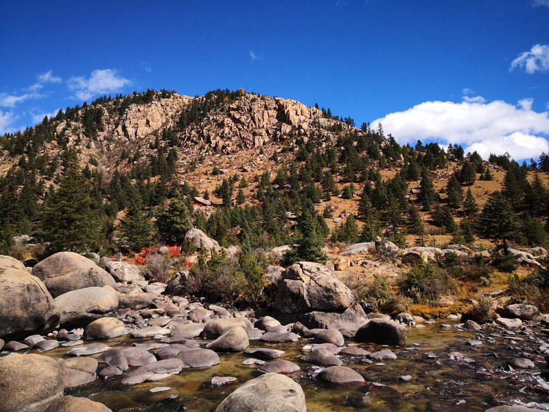
The red grassland in the Sangdui of Daocheng is not large in area, only about one or two basketball courts. The red water grass and yellow leaves in the distance set off each other, forming a unique landscape


Daocheng White Pagoda
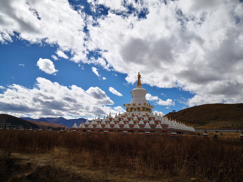
Passing through Mount Pova
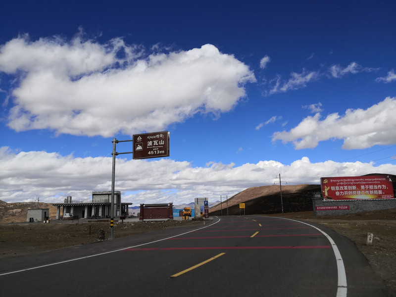
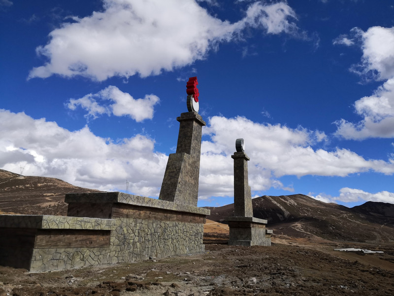


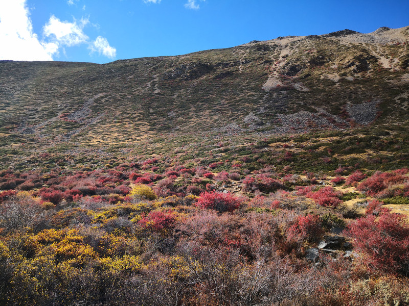
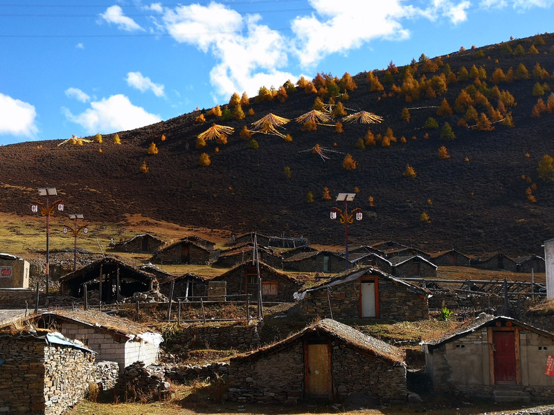
After climbing a few mountains, I was surprised and surprised to see these low stone houses. Later, I learned that Tibetans who dug Cordyceps had built them temporarily and lived here. They would leave after digging Cordyceps and come back the next year.
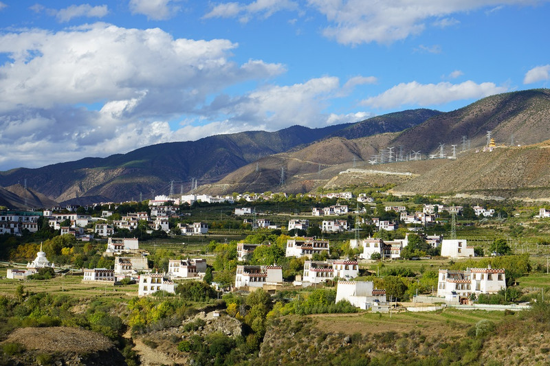
Entering the rural city, you will find the white Tibetan houses on both sides of the river, known as the "white houses".
Interesting ladder

Live in Tibetan residence


day 49 Xiangcheng
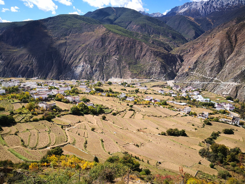
A white Tibetan village surrounded by mountains and rivers. On sunny days, the valley is like terraced fields, dotted with white Tibetan houses, casual and natural.


The east gate of Sangpiling Temple has two round carvings of whole wood. The carvings are the symbol of "harmony and the four auspicious signs"-elephants, monkeys, rabbits and auspicious birds, a token of "harmony for good" that the Tibetan people believe in "harmony is good". The beam of the gate is carved with four precious beasts: tiger, lion, carving and dragon.
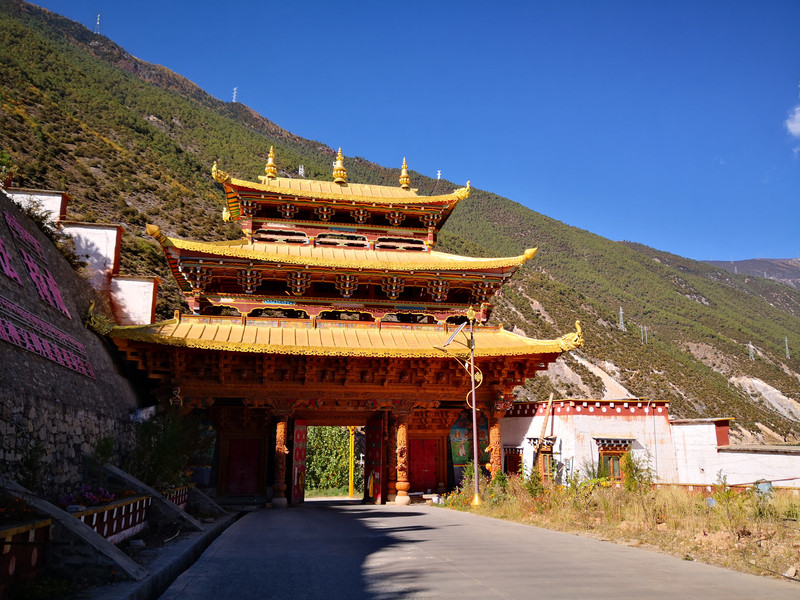
In Sangpiling Temple, exquisite carvings and paintings can be seen everywhere. Various Buddha statues, birds and animals have various shapes. Various auspicious patterns common to Tibetan Buddhism are depicted in the capital, beam squares, and corridor roofs.


Exquisite stupa

Buddhist monk


In Zhongde Village, Qingde Township, Xiangcheng County,"Passing Through Your World" is presented one by one at the Xiangcheng shooting point, passing through Fan Road, and on the radio station


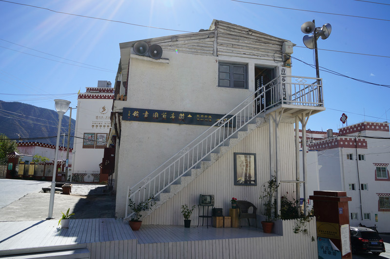


A very artistic B & B

Ranwu Township Hot Spring, after soaking in the hot spring, the whole body is smooth

day 50 Xiangcheng to Shangri-La
Starting southeast from Xiangcheng County, Sichuan, you will take a section of the Great Rift Valley (roadside temporary sign Z001), which is not yet named on the map, about 100 kilometers, and the journey is 257 kilometers.

From the rural city to Shangri-La in Diqing, Yunnan, take a newly built road, accompanied by green rivers along the road

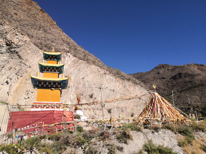


Sechong Bridge, drive across the bridge and take a "Zhi"-shaped mountain road. The mountain shape is steep and your feet are sore when driving.


Entering the Napa Sea, the snowy peaks are reflected in the lake. The alpine pastures at the foot of the mountain are flocked of cattle and sheep, presenting a beautiful picture of pastoral songs.

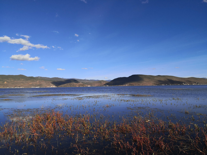


Time-honored local chicken soup, business is booming
day 51 Shangri-La to Tiger Leaping Gorge
Shangri-La County reaches Baishuitai and reaches Tiger Leaoxia Town in the evening. Due to the construction of the entire Xianghu Highway, there was no time to take pictures of the entire scenery except Baishuitai. Most of them were avoiding pits and eating dust, covering a journey of 198 kilometers.

Take the Shangri-La East Ring Road to Baishuitai Scenic Area. The scenic area is surrounded by white Baishuitai, which is as white as fat, and is layered like a Yaochi Wonderland.
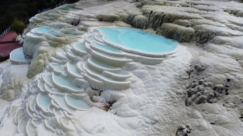
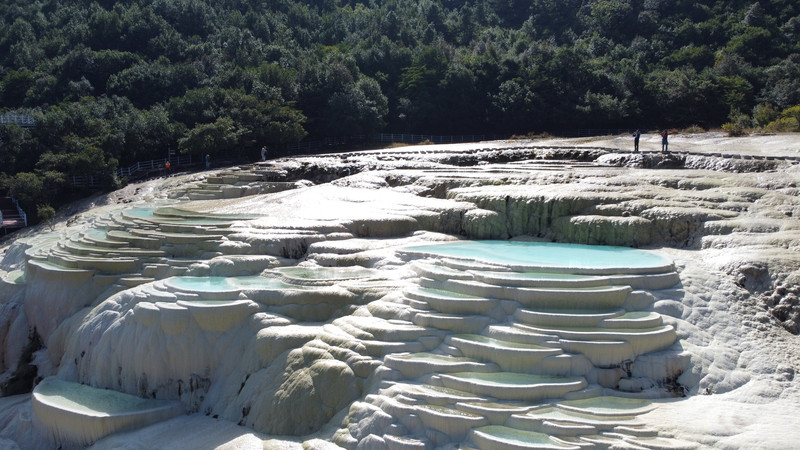
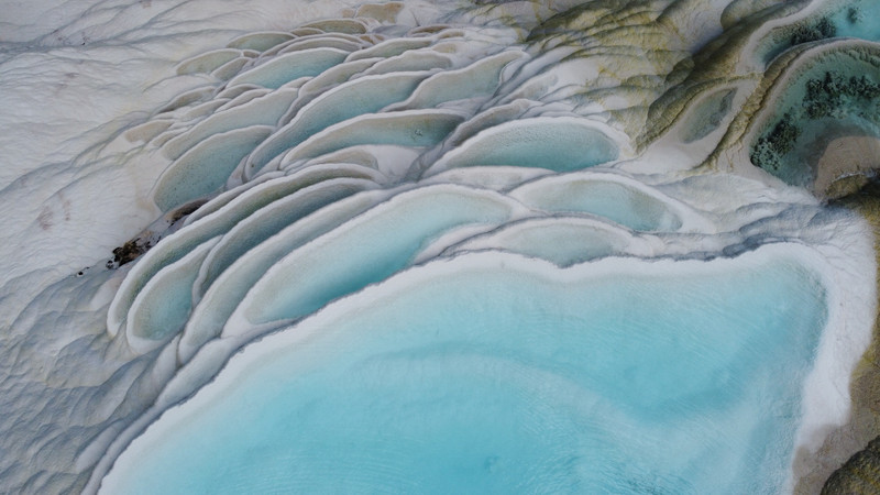


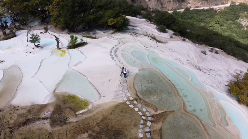
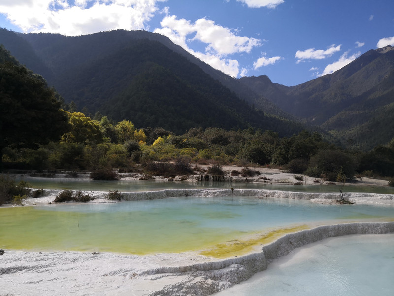
A road is being built from Baishuitai to Tiger Leaping Gorge. The road is muddy and uneven, with steep cliffs on one side. You have to travel to avoid it. It is lucky that you can reach the hotel safely. You know, the road was closed the next day
day 52 Tiger Leaping Gorge to Jianchuan Shaxi Ancient Town
Bypass Lijiang from Tiger Leaping Gorge Town and temporarily make a move to Shaxi Ancient Town. It crosses Jianchuan County and enters the mountains for more than 30 kilometers, and reaches Shaxi Ancient Town, which is 115 kilometers.

Gongxili Hotel next to National Highway 214 has an antique and elegant environment

Lunch in Tiger Leaping Gorge

View from the restaurant window

Stay in Shaxi Ancient Town

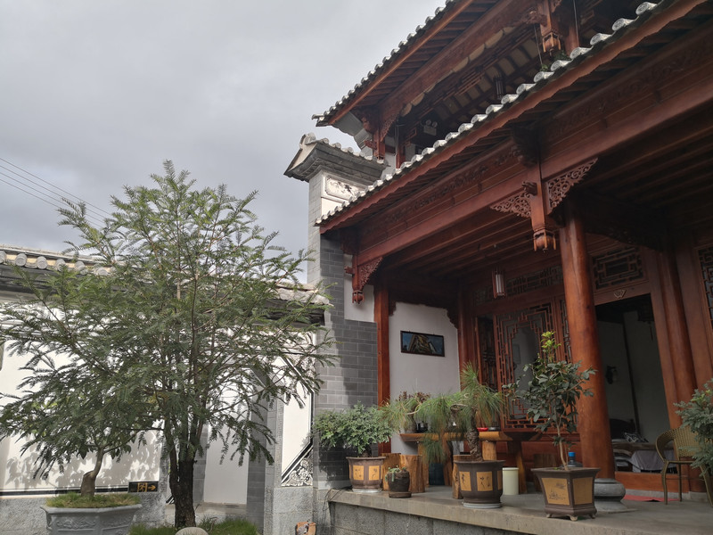
Ancient town in the evening

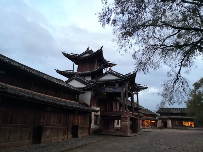


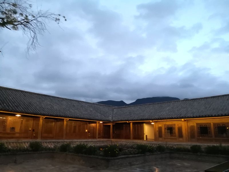

day 53 Jianchuan Shaxi Ancient Town
In addition to these cultural landscapes, ancient alleys, ancient temples, ancient stages, and ancient bridges, accompanied by the century-old tree next to the horse shop and the lazy sofa outside the inn, time seems to have stopped.


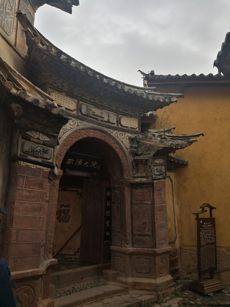


The dishes in the ancient town are also to my liking. It is the mushroom season. I bought mushroom oil as a gift and brought it back.

goodbye
I traveled to Guangdong from Jianchuan. Looking back on the entire journey, the two of them and one car took 57 days and traveled 18,000 kilometers. Every trip, feeling carefully is the most important. The most beautiful National Highway 317 and the extremely tempting 219 are still vivid in my mind. From time to time, I can see familiar scenery on the TV screen and proudly comment on it. I am looking forward to my next departure, the scenery is always on the way.
Previous Article:Yunnan: South of the colorful clouds, long memories-15-day tour of Yunnan
Next Article:Ten miles of spring breeze, the most beautiful river, a person's life in the floating world!
