Kunming weekend leisure outdoor hiking, mountaineering photography and camping?
Yunnan, China-The spring city of Kunming is a beautiful and clear place in the hearts of people, with clean mountains and rivers, simple ethnic minorities, and bright national costumes...
As well as the winding mountains created by nature, and the climbers who have gradually developed a climate, they are intertwined into a beautiful picture that makes people yearn for.
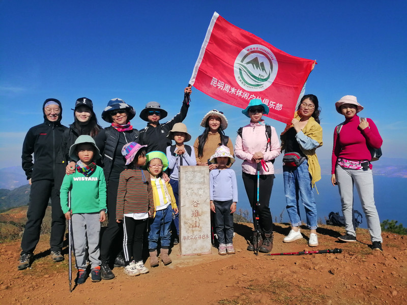
People who are good at climbing mountains are never afraid of how high the mountains are or how dangerous the roads are. They move forward bravely towards the set goal without hesitation, discouragement or flinching. Although I know that it is impossible to withstand the cold at high places, I insist on looking for greatness in the cold. He had a firm belief in his heart that no matter how high and steep the mountain was, it could not stop him from moving forward. For those who are not good at mountain climbing, they do not know that the infinite scenery lies on the top of the mountain, let alone the majesty of standing in the clouds and "seeing the mountains at a glance".

The following are suggestions from grassroots outdoor enthusiasts: Use it on mountains below 4000 meters

1. Safety principles for mountain climbing on weekends-preparation before travel
1. Dress up the mountain lightly and bring less luggage to avoid excessive physical exertion.
2. The climate in mountainous areas is changeable, so it is best to bring a raincoat rather than an umbrella.
3. The temperature on the mountain is low in the morning and at night, so it is recommended to bring a thick coat.
4. Do not wear leather shoes, high heels, or plastic-soled shoes for mountain climbing. You should wear outdoor hiking shoes.
5. You can prepare hiking poles or bamboo sticks as appropriate.
6. Bring enough water and food to drink.
7. It is best to carry emergency medicine with you.

2. Safety principles for mountain climbing on weekends-pay attention while traveling
1. Walking without looking at the scenery, watching the scenery without walking.
2. Adjust your pace and breathing while moving, and do not rush or slow down.
3. When climbing the mountain, the body leans forward slightly, and you can walk in a "zigzag" shape, which saves effort and ease.
4. Don't hold the backpack in your hands, carry it on your shoulders.
5. Don't swim in pools that don't know the depth of the mountains.
6. Drink moderate water, not binge drinking.
7. If you are unwell, rest in due course.
8. Use the fire carefully and don't throw cigarette butts around.
9. If you encounter a thunderstorm, don't go under a tree.
10. When there is heavy rain in mountainous areas, flash floods come very hard and are very fast. It is not advisable to wash clothes or play in the river on the eve of rain.
11. It is best to follow the road signs left by predecessors to identify directions, or mark marks along the way.
12. After dark, avoid walking in ravines or unfamiliar routes.
13. When you get lost, you should turn back your way or find shelter and wait for rescue.
14. It is best to go hiking in the morning or morning, and you should go down the mountain and return to your station in the afternoon. Don't change the climbing route and time without authorization.

Outdoor ashes expert advice·Please choose the mountain that suits you

3. Safety principles for mountain climbing on weekends-precautions for traveling together
1. Don't climb high and risk alone. It's best to go together and take care of each other.
2. The climbing team should not stretch too long and should keep echoing back and forth.
3. Remove at least 2 people from the company and avoid acting alone.
4. Carry forward the team spirit, pay attention to the situation of companions on the way, and remind each other in dangerous areas or assist in passing.

4. Safety principles for mountain climbing on weekends-safe taking photos
1. Check the camera power before traveling.
2. The mountain road is bumpy, be careful not to bump the camera, and put the camera box back when traveling.
3. When taking photos on high and dangerous mountains, do not move after selecting the angle, let alone retreat, to prevent accidents.
4. It is best not to take photos on dangerous cliffs, let alone pursue photo effects and "flip the bar" to take photos.
5. Do what you can and do not make dangerous actions in pursuit of beautiful scenery.

The introduction of Kunming's ten peaks is in no order
The Kunming Ten Peak Mountaineering Activity is a mass mountaineering activity advocated by the Kunming Mountaineering and Expedition Association. It aims to promote a series of mountain climbing plans for national fitness mountaineering in our city. Except for Jiaozi Mountain, which is a scenic spot, the rest of the ten peaks are natural and pristine ecological environments. There are no relevant safety instructions, road signs and facilities, and there are no professional personnel (ten peak guides) to guide them. There are still certain risks, so we do not advocate individuals going spontaneously.
(Jinning) Gudui Mountain

Gudui Mountain, also known as Daliangzi, is the highest peak in Jinning County, about 60 kilometers away from Kunming. At the junction of Jiangchuan, Chengjiang and Jinning Counties, there are also beautiful views of the three seas from one mountain (namely Fuxian Lake, Xingyun Lake, and Dianchi Lake). Most of the way up the mountain are mountains, grass slopes and shrubs. In summer and spring, grass and flowers are in full bloom on the slopes, making the scenery extremely beautiful.
Altitude:2648
Difficulty Index:★★
Landscape Index:★★★
Cultural index:★★
Daily itinerary: One day
Walking distance:8-12 kilometers

Heifeng Mountain (Anning City)
The black wind mountainous area is an ideal area for outdoor athletes to conduct "devil training" through mountain travel. In recent years, I don't know how many young people and mountain friends have undergone baptism in Heifeng Mountain.
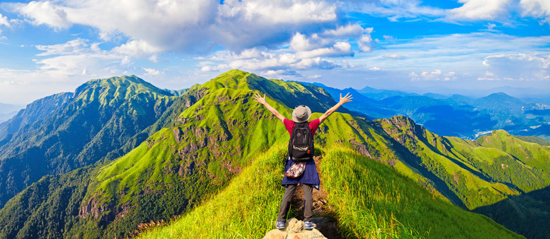
Introduction to Heifeng Mountain: Heifeng Mountain is located in Mingyihe Township, Bajie Township, and Xianjie Township, Anning City, Kunming City. It is about 60 kilometers away from the urban area of Kunming. The mountain runs north-south, with towering peaks and rolling peaks, with a radius of more than 100 square kilometers, with an average altitude of 2500 meters. The main peak Damu Mountain (also called "Li Dazhang Tomb Mountain" by locals) is 2617 meters above sea level. It is the highest peak in Anning City and the boundary between Anning City and Yimen County in Yuxi Prefecture. The entire mountainous area has dense vegetation, green green onions, and clear streams. Anning County annals say:"This mountain is named because it cannot see the sun when entering the mountain. "Heifeng Mountain is surrounded by mountains and mountains. The height difference of the mountain on the east side is 720 meters, and the height difference of the Bahe River Valley on the west side is 1020 meters. It belongs to a deep-cut Zhongshan landform. Most of the mountains are small pine forests, and there are evergreen broad-leaved forests and thorny shrubs in the green valleys. There are five large reservoirs around it, namely Daqing Reservoir and Dongshan Reservoir in the northwest; Daguchang Reservoir in the southwest; Fengyi Reservoir in the southeast; Xiaoqingkou Reservoir in the northeast; and there is also a small reservoir hidden in the center, named "Xiaocungu Reservoir." There are more than ten valleys and gullies distributed in all directions. The famous ones are Laoyang Qing, Zongmianqing, Cypress Qing, Cuotou Qing, and Dayu and Xiaoyu Dongqing. There are various birds and wild animals in the mountains, such as cuckoo, orchid feather, wild boar, stone jumping, snake, etc.
Altitude:2617
Difficulty Index:★★
Landscape Index:★★★
Cultural index:★
Schedule: One day
Hiking distance:16 kilometers

Laogui Mountain (Shilin County)

Laogui Mountain is named "Laogui Mountain" because its majestic and beautiful mountains are shaped like the raised back of a turtle. It was later transliterated as "Laogui Mountain". It is called "Gouboma" in Yi language, meaning "Mountain of Wild Goose". It is a famous Buddhist mountain in central Yunnan, the birthplace of Chinese Ashima culture, and the highest peak in Shilin County, Kunming City (2601 meters above sea level, N 24°37.630' E 103° 34.721'). It is 14 kilometers long from north to south and 10 kilometers wide, with a total area of 3206 hectares, which is the remnant of the Yunling Mountains. The terrain in the northeast is gentle, and the mountains in the southwest are steep, steep cliffs, and dangerous forest peaks merge into one. The mountains are round and high into the clouds. It belongs to a subtropical, low-latitude, high-thick mountainous climate. The annual rainfall is 970 mm, and the annual average temperature is 14°C. The average frost-free period is 210 days, and the average monthly temperature changes little.
Altitude:2601
Difficulty Index:★
Landscape Index:★★★
Cultural index:★★★
Schedule: One day
Hiking distance:6-8 kilometers

[Fumin County] Jindongpen Mountain

Jintongpen Mountain is located in Zhebei, about 30 kilometers away from Fumin County, with an altitude of 2834 meters. It is one of the ten highest peaks in Kunming and the highest peak for Fumin. There are three legends. First, it is said that there was once a golden basin in a low-lying place at the foot of the main peak. The water in the basin would not dry up all year round. It was the drinking water source for surrounding villagers. Later, the golden basin was taken away by a greedy man, and the water source was also cut off. Second, Jindongpen Mountain is named because the mountain shape looks like an inverted gold and copper basin. Third, according to local villagers, Jindongshan got its name because someone dug a gold and copper basin on the top of the mountain.
Altitude:2817
Difficulty Index:★ ★
Landscape Index:★★
Cultural index:★
Schedule: One day
Hiking distance:11 kilometers

[Yiliang County] Laoye Mountain

Laoye Mountain was formerly known as Wuna Mountain. It is the highest peak in Yiliang County and Guandu District of Kunming City (altitude of 2730 meters, coordinates N25°2.042' E103° 0.781'). It is located in the north of Tangchi Town, Yangzonghai. Facing northeast-southwest, the mountain is about 22 kilometers long, about 3 kilometers wide, and covers an area of 66 square kilometers. The mountain is made of Paleozoic Permian basalt-limestone. The average altitude is more than 2400 meters. There are 19 peaks around the main peak. The height difference in the southeast of Laoye Mountain is 930 - 950 meters. It belongs to the cutting Zhongshan landform.
Altitude:2730
Difficulty Index:★★
Landscape Index:★★
Cultural index:★★
Schedule: One day
Hiking distance:9 kilometers

[Chenggong District] Liangwang Mountain

The King of Liang was named after the grandson of Genghis Khan in the Yuan Dynasty inherited the title "King of Liang". The King of Liang, the highest ruler of Yunnan in the Yuan Dynasty, built the Liang Palace on the top of the mountain and practiced martial arts for a hundred years. There are several ancient military training grounds and ruins. Liangwang Mountain is located between Chengjiang County and Chenggong County, more than 40 kilometers away from Kunming. The mountain stretches more than 100 kilometers from south to north. The mountains are majestic and magnificent, with towering cliffs in the west, tall and steep, and peaks in the east, with ancient trees towering into the sky. The highest altitude is 2820 meters, making it the highest peak in central Yunnan. You can have a panoramic view of hundreds of miles around, and "one mountain views three seas"(i.e. Yiliang Yangzong Sea, Kunming Dianchi Lake and Chengjiang Fuxian Lake). In summer and autumn, you can see the peaks shrouded. Perhaps white clouds surround the mountainside, which is mostly a sign of rain. In autumn, the mountains and flowers are blooming and prosperous, so there is a scene of "Liang Peak and Rain, White Cloud and Autumn Autumn."
Altitude:2820
Difficulty Index:★★
Landscape Index:★★★
Cultural index:★★★
Schedule: One day
Hiking distance:6-9 kilometers

[Songming County] Dajian Mountain

Dajian Mountain, also known as Sanjian Mountain, is the highest peak in Songming, with an altitude of 2840 meters. It is one of the ten peaks in Kunming and the fourth of my ten peaks. Located in the northwest of Songming County, the mountain is about 33 kilometers long and 16 kilometers wide. The vegetation coverage among the mountains is very high, and most of them are coniferous forest belts. There are large grass dams in the mountains, large patches of Yunnan pine forests, and azaleas and various flowers and plants bloom in spring and summer. Climbing to the peak, you can enjoy the vast beauty of the entire Songming Bazi world.
Altitude:2840
Difficulty Index:★★
Landscape Index:★★★
Cultural index:★★
Schedule: One day
Hiking distance:7-10 kilometers
[Xundian County] Huashitou Mountain

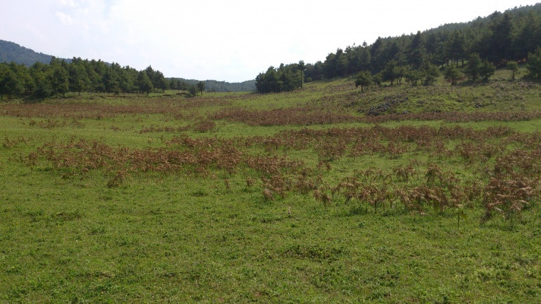
The main peak of Huashitou Mountain, Julongliangzi, is the highest peak in Xundian County (3294 meters above sea level). It is named because the mountain looks like a giant dragon lying across the northern part of Xundian County. The main peak is located in the northwest of Gongshan Township. There are countless peaks around the main peak. The peak is higher than 3000 meters high, and the top of the mountain is gentle. The mountain canyons are deep, the lower part of the mountain is densely forested, and there is little vegetation in the upper part, but the top of the mountain is very beautiful, gentle and vast. There are large tracts of grass mountains, pastures, green grass and beautiful small flowers, and there are countless strange huge rocks across the river. The different looks are amazing.
Altitude:3294
Difficulty Index:★ ★
Landscape Index:★★★
Cultural index:★★
Schedule: 2 days
Hiking distance:8 kilometers
[Luquan County] Sedan Snow Mountain

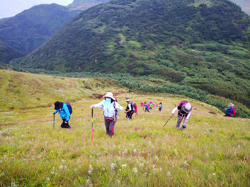
Jiaozi Mountain Scenic Area is located in Wumeng Township, Beiluquan County, Kunming City. It is surrounded by the Jinsha River in the north and looks at Kunming in the south. It has a radius of more than a hundred miles, with several peaks that look like a sedan chair from a distance, hence the name. During the Tang Dynasty, Luo Feng, the king of Nanzhao, followed the example of the king of the Tang Dynasty's canonization of the five mountains and granted this mountain the title of Lenibai, the Eastern Mountain. The main peak of Jiaozi Mountain is 4223 meters above sea level and the relative height difference is nearly 3000 meters. Due to its unique topography, it presents a three-dimensional climate. The scenic area covers an area of 253 square kilometers, with clouds of clouds, Buddha's light, sunrise, ice and snow world, and azalea sea. It is known as the "Five Wonders" of Jiaozi Mountain. In addition to the beauty of Emei and the steepness of Huashan, Jiaozi Mountain also has a unique natural landscape. There are three alpine lakes of varying sizes on the mountain, as well as alpine meadows, making Jiaozi Mountain even more charming.
Altitude:4223
Difficulty Index:★ ★
Landscape Index:★★★★
Cultural index:★★★
Schedule: Two days
Hiking distance:8-10 kilometers

[Hongtudi Township, Dongchuan District] Xueling
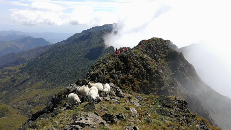
Xueling is located east of the Pudu River and south of the Jinsha River. It is located in Hongtidi Township, Dongchuan District. It is the main peak of the Gongwang Mountains and is about 200 kilometers away from Kunming. It is the highest peak in central Yunnan and the highest peak on the Yunnan-Guizhou Plateau. There is snow on the top of the mountain in winter. Under the sunset glow, the snowy mountains are magnificent orange-red, as bright as fire and extremely magnificent. People call them "Xuehuo Ridge". There are two alpine lakes on the mountain, the real white dragon and the fake white dragon. Xueling is the most difficult, highest and most dangerous among the ten peaks in Kunming. Participants are reminded that they must have considerable conditions and qualified guides before climbing. The mountain was selected among the top ten non-famous peaks in the country launched by China National Geographic magazine and website in 2009, which greatly increased the popularity of the mountain and deserves our joy.
Altitude:4344
Difficulty Index:★ ★
Landscape Index:★★★★
Cultural index:★★
Schedule: Two days
Hiking distance:8 kilometers

Previous Article:Nanchang-Kunming-Dali-Lijiang-Shangri-La-Lugu Lake-Chongqing-Nanchang, self-driving 5702.1 kilometers in 16 days
